한국어로 페이지 보기
Seoul ADEX 2025 Digital Directory
Plan your trip to Seoul ADEX 2025 using our state of the art Digital Directory
Register in seconds with just your email


Directory Features
To help you at the show
In-depth Exhibitor Profiles
Each exhibitor can add as many products and services as they wish, with in-depth information and specifications. This allows buyers to find what they want easily.
Self Provisioning for Exhibitors
Each exhibitor has full control of their content - to edit their company profile, upload products and enter staff details.
Plan your trip
Use the bookmarking and event planning tool to research the companies you would like to visit and the products you are interested in finding. You will be able to locate all of your saved companies on our floorplan
Advanced Search
Utilize our advanced search function to quickly locate products, people, and companies. Our state-of-the-art technology thoroughly scans all exhibitor information, delivering precise and relevant results
Interactive Floorplan
Navigate the show effortlessly with our directory. Use the floorplan to locate companies you want to visit and to find your way to onsite restaurants, toilets and site entrances and exits.
On-platform Messaging
Reach out to exhibitors and visitors directly on our platform to set up meetings, or request more information.
Some of our latest content
Companies, Products, News, Events
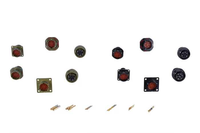
AeroMaster Corporation (AMC)
EVMU
Receives vibration signals from an accelerometer installed on the aircraft engine and monitors engine vibration.
Processes real-time vibration signals and converts them into IPS AVG units for output.
Developed for localization, achieving 50% cost competitiveness compared to equivalent products.
- x1 MIL-STD-1553B
- x2 UART(RS-422/485)
- x2 Accelerometer sensor
- Sample rate : Up to 5,000Hz
- Size : 220 x 206 x 52 (mm)
- Weight : 1.75Kg
- Environment : MIL-STD-810G
- EMI/EMC : MIL-STD-461G
- Power : MIL-STD-704F (28VDC, 10W)
Marvin Test Solutions
F-35 Test and Support Equipment
LUMIR
Space Internet Communication Device for Lunar Exploration, DTNPL
Lumir, in collaboration with the Electronics and Telecommunications Research Institute (ETRI), developed and integrated this device for lunar exploration aboard Danuri (KPLO, the Korea Pathfinder Lunar Orbiter), Korea's first lunar probe. This device successfully demonstrated its performance by receiving BTS music videos transmitted from the Moon to Earth, achieving Technology Readiness Level (TRL) 9.
MTG
Near-Field Measurement System
Near-field Ranges calculate Far-field pattern based on amplitudes and phase samples in radiating near-field region mathematically. Near-field Ranges have various testing configurations-planar, cylindrical and spherical. Planar Near-field range is suitable for directional antennas. Cylindrical Near-field range is suitable for antennas with wide side/back lobes and fan beam antennas. Spherical Near-field Range is suitable for any type of antennas. You can choose reasonably defending your conditions. MTG has many experience supplying Far-field ranges as well as Near-field ranges. MTG work with many companies including munitions industries, laboratories, telecommunication corporations, and antenna corporations. We can provide a series of positioner, probes and Near-field measurement software.
View page in English


디렉터리 기능
전시회 도우미
In-depth Exhibitor Profiles
Each exhibitor can add as many products and services as they wish, with in-depth information and specifications. This allows buyers to find what they want easily.
Self Provisioning for Exhibitors
Each exhibitor has full control of their content - to edit their company profile, upload products and enter staff details.
방문 계획 수립
북마크 도구와 이벤트 플래너를 사용해 방문하고자 하는 기업과 관심 있는 제품을 검색하세요. 저장한 모든 항목을 조회할 수 있습니다
고급 검색
고급 검색 기능을 사용하여 상품, 인물, 기업의 위치를 빠르게 조회할 수 있습니다. 최첨단 기술을 통해 모든 참가사의 정보를 철저히 스캔하여 세밀하고 관련성 있는 정보를 제공합니다
상호작용 가능 평면도
디렉터리를 사용해 전시회를 손쉽게 둘러보세요. 방문하고자 하는 기업의 위치와, 행사장 내 식당, 화장실, 출입구를 평면도에서 찾을 수 있습니다.
플랫폼 내 메시지
플랫폼 상의 전시 참가사와 관람객에게 직접 연락하여 미팅을 신청하거나 추가 정보를 요청하세요.
최신 콘텐츠
기업, 상품, 뉴스, 이벤트
GEOSTORY Co., Ltd
Bathymetric LiDAR System
Our LiDAR uses a custom-designed laser that separates 1064 nm and 532 nm wavelengths from a single source, with two dedicated receivers capturing each set of data independently.
Inside the system, the linear laser beam is refracted at a 10-degree angle through a prism to enable circular scanning. An RF module is also integrated for real-time equipment status monitoring.
From circuit board design to component selection, every part of this system was developed in-house by multiple institutions.
As a result, we have successfully eliminated reliance on foreign technology.
Orbit Communication Systems
Tracking Telemetry and Command Antenna Solutions
Orbit’s TT&C ground stations antenna must function flawlessly in order to provide a narrow beam width link in one-time single opportunity, flight test event. Add this factor to the turbulent weather that is often present at the ground station locations, and you are looking at a formidable hurdle.
Orbit provides fixed, transportable, and portable antenna systems that feature auto-track, RSSI-track and GPS track
tracking modes, unsurpassed tracking accuracy and durability to deliver the stable connection required for dependable data throughput. Our stabilized T&T antenna systems work in extreme temperature conditions (-40°C to 55°C) and in rough weather, for example, at base stations that are close to the ocean or on high mountain ranges.
LUMIR
Image Data Handling Unit, IDHU
Lumir is the first Korean company to successfully develop and manufacture this onboard equipment, delivering superior performance and significant cost savings compared to competitors’ products. By integrating non-volatile NAND flash devices into the image data handling unit, storage capacity has been significantly increased, with data retention maintained even when the power is off.The image data handling unit of the satellite is a core device that receives high-speed, large-capacity data output from Earth observation sensors mounted on the satellite—such as SAR or optical cameras—then compresses and stores the data in real time, while also performing encryption and encoding for transmission to ground stations. Lumir has successfully developed and manufactured this satellite-mounted device domestically in Korea for the first time, breaking reliance on imported technologies. This achievement secures Lumir’s competitiveness by delivering superior performance and significant cost savings compared to foreign products.
General Atomics Aeronautical Systems, Inc.
MQ-9B SkyGuardian
MQ-9B SkyGuardian® is the next generation of remotely piloted
aircraft systems (RPAS), delivering persistent intelligence,
surveillance, and reconnaissance (ISR) around the globe.
SkyGuardian is designed to fly over the horizon via satellite for up
to 40 hours in all types of weather and safely integrate into civil
airspace, enabling joint forces and civil authorities to deliver real-time
situational awareness anywhere in the world—day or night. Featuring
a longer wingspan than its predecessors at 79 ft (24 m), the aircraft is
outfitted with the revolutionary Lynx® Multi-mode Radar, an advanced
electro-optical/infrared (EO/IR) sensor, and automatic takeoff and
landing capability. In addition to its industry-leading endurance and
superior surveillance capabilities, SkyGuardian seamlessly integrates
with its users’ other platforms, systems, and podded technologies,
dramatically expanding the aircraft's multi-domain mission set
aircraft systems (RPAS), delivering persistent intelligence,
surveillance, and reconnaissance (ISR) around the globe.
SkyGuardian is designed to fly over the horizon via satellite for up
to 40 hours in all types of weather and safely integrate into civil
airspace, enabling joint forces and civil authorities to deliver real-time
situational awareness anywhere in the world—day or night. Featuring
a longer wingspan than its predecessors at 79 ft (24 m), the aircraft is
outfitted with the revolutionary Lynx® Multi-mode Radar, an advanced
electro-optical/infrared (EO/IR) sensor, and automatic takeoff and
landing capability. In addition to its industry-leading endurance and
superior surveillance capabilities, SkyGuardian seamlessly integrates
with its users’ other platforms, systems, and podded technologies,
dramatically expanding the aircraft's multi-domain mission set
Digital Directory