한국어로 페이지 보기
Seoul ADEX 2025 Digital Directory
Plan your trip to Seoul ADEX 2025 using our state of the art Digital Directory
Register in seconds with just your email


Directory Features
To help you at the show
In-depth Exhibitor Profiles
Each exhibitor can add as many products and services as they wish, with in-depth information and specifications. This allows buyers to find what they want easily.
Self Provisioning for Exhibitors
Each exhibitor has full control of their content - to edit their company profile, upload products and enter staff details.
Plan your trip
Use the bookmarking and event planning tool to research the companies you would like to visit and the products you are interested in finding. You will be able to locate all of your saved companies on our floorplan
Advanced Search
Utilize our advanced search function to quickly locate products, people, and companies. Our state-of-the-art technology thoroughly scans all exhibitor information, delivering precise and relevant results
Interactive Floorplan
Navigate the show effortlessly with our directory. Use the floorplan to locate companies you want to visit and to find your way to onsite restaurants, toilets and site entrances and exits.
On-platform Messaging
Reach out to exhibitors and visitors directly on our platform to set up meetings, or request more information.
Some of our latest content
Companies, Products, News, Events
EMCORE
GEO-FOG 3D Dual Inertial Navigation System (INS) (Non-ITAR)
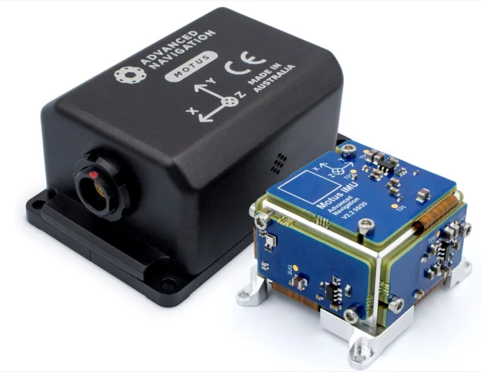
EMCORE’s exclusive photonic integrated chip (PIC) technology delivers improved reliability and repeatability. The precision non-ITAR GEO-FOG 3D Dual features two GNSS antennas on a fixed PTK baseline to offer increased heading, pitch, and roll accuracy for static and dynamic applications where a single antenna system can be problematic. This dual antenna INS is the best choice for systems requiring heading at start-up or in low dynamic conditions.
Highlights
Data rate 10x faster than other available systems
Cutting-edge sensor fusion for dependable, precise navigation in a full array of applications and conditions
Six degrees of freedom (DoF) IMU with integrated gyros and accelerometers
Technology Details
Photonic Integrated Chip Technology
EMCORE’s new photonic integrated chip (PIC) technology reimagines FOG technology by replacing individual fiber components with an innovative integrated planar optic chip. This results in a FOG with PIC Inside™ that’s even more reliable and delivers superior repeatability unit-to-unit. With three of these integrated photonic gyros at its core, the P-1750 IMU enables the GEO-FOG to provide the safe, accurate performance autonomous platforms demand.
Learn More
DSP Technology
EMCORE’s DSP electronics improve FOG performance in critical areas such as scale factor and bias vs. temperature, scale factor linearity, and maximum input rate. EMCORE’s exclusive DSP design overcomes the limitations of analog signal processing, eliminating temperature-sensitive drift and rotation errors.
GEO•FOG Manager
The GEO•FOG Manager is ideal when integrating EMCORE’s GEO•FOG 3D and GEO•FOG 3D Dual INS.
Learn More
Developer’s Kit for Rapid Integration
The KVH FOG/IMU Developer’s Kit includes easy-to-use software to accelerate your IMU and FOG integration, development, and interface efforts.
Parkor Korea Indus
MAX 3D 360° AVIAN DETECTION
1. 360° COVERAGE IN 3D : We innovated full 360°, 3D systems to give you complete awareness of what’s happening all around you, all year round. Day or night. MAX tracks thousands of birds simultaneously, displaying data in its intuitive interface.
2. LIGHTNING-FAST ROTATION : MAX’s market-leading rotation speed delivers fast track updates for precise tracking and classification. Multiple stacked beams also mean advanced clutter filtering for the most accurate readings.
3. INSIGHTS AT YOUR FINGERTIPS : Historical data is as important as real-time insight, so MAX has a long memory. Visualise environmental conditions, bird size, speed, altitude and more with Report Viewer for risk collision models and effective mitigation.
Teledyne FLIR LLC
FLIR DET ETD Guidebook 2020
EXPLOSIVES DETECTION
10 things to know when investing in
an explosives trace detector
MPS bearings Co., Ltd.
Zoom mechanism
This miniaturized system allows, depending on the desired configuration, to move very precisely between 1 and 3 sets of lenses over a stroke of several centimeters. The design has been optimized to ensure perfect alignment of the lenses and to minimize their tilt throughout the movement. This optomechanical system mainly consists of high-precision standard MPS and FAULHABER modules, such as brushless or stepper motors, ground ball screws with double nuts and linear ball bearings. It is particularly recommended for focusing a laser over a long distance, for example for the guidance of unmanned flying objects or for communication between flying objects. The number of lens sets, lens size and stroke can be configured at will.
View page in English


디렉터리 기능
전시회 도우미
In-depth Exhibitor Profiles
Each exhibitor can add as many products and services as they wish, with in-depth information and specifications. This allows buyers to find what they want easily.
Self Provisioning for Exhibitors
Each exhibitor has full control of their content - to edit their company profile, upload products and enter staff details.
방문 계획 수립
북마크 도구와 이벤트 플래너를 사용해 방문하고자 하는 기업과 관심 있는 제품을 검색하세요. 저장한 모든 항목을 조회할 수 있습니다
고급 검색
고급 검색 기능을 사용하여 상품, 인물, 기업의 위치를 빠르게 조회할 수 있습니다. 최첨단 기술을 통해 모든 참가사의 정보를 철저히 스캔하여 세밀하고 관련성 있는 정보를 제공합니다
상호작용 가능 평면도
디렉터리를 사용해 전시회를 손쉽게 둘러보세요. 방문하고자 하는 기업의 위치와, 행사장 내 식당, 화장실, 출입구를 평면도에서 찾을 수 있습니다.
플랫폼 내 메시지
플랫폼 상의 전시 참가사와 관람객에게 직접 연락하여 미팅을 신청하거나 추가 정보를 요청하세요.
최신 콘텐츠
기업, 상품, 뉴스, 이벤트
GEOSTORY Co., Ltd
Bathymetric LiDAR System
Our LiDAR uses a custom-designed laser that separates 1064 nm and 532 nm wavelengths from a single source, with two dedicated receivers capturing each set of data independently.
Inside the system, the linear laser beam is refracted at a 10-degree angle through a prism to enable circular scanning. An RF module is also integrated for real-time equipment status monitoring.
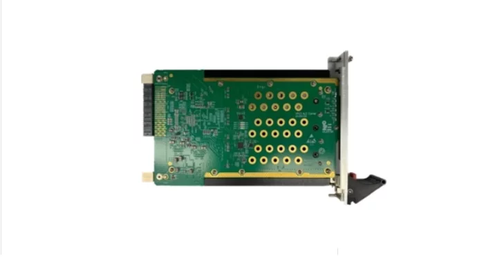
From circuit board design to component selection, every part of this system was developed in-house by multiple institutions.
As a result, we have successfully eliminated reliance on foreign technology.
LUMIR
Control Moment Gyro Controller for High-Speed High-Mobility Satellite
Primarily used in medium-sized and large satellites, it provides high torque performance and momentum conservation. By localizing the Control Moment Gyro controller, which had previously been imported for Korea’s domestic satellite industry, Lumir has gained a competitive advantage in both performance and cost.
Marvin Test Solutions
GENASYS 5G mmWave Semiconductor Test Systems
In this video, you will learn about the capabilities and performance benefits of our 5G mmWave semiconductor test system, the GENASYS Semi TS-900e-5G. GENASY...
funzin
EagleEye
Solution Overview
EagleEye is a a synthetic data generation & management platform for AI training that integrates image generation, LLMOps, and MLOps. It automates high‑quality dataset generation, labeling, and model validation—and has been certified “military suitable” and delivered first to the ROK Army AI Center.
Main Features
Image generation with text/image prompts; object/background customization
LLMOps: prompt understanding + image–text labeling workflow
MLOps: CV model training/validation, dataset versioning, experiment tracking
End‑to‑end pipeline from data preprocessing to model deployment
Data augmentation and management for scalable, repeatable training
Key Advantages
Certified “military suitable”; meets defense operational requirements
First AI solution supplied to the ROK Army AI Center, proving reliability
One‑stop synthetic data + model ops cuts development/validation time
Fully in‑house stack enables rapid updates and mission‑tailored customization
2025: First AI product delivered to the ROK Army AI Center for defense AI projects
Used to generate and manage high-quality synthetic imagery for military AI model training and validation
Digital Directory