한국어로 페이지 보기
Seoul ADEX 2025 Digital Directory
Plan your trip to Seoul ADEX 2025 using our state of the art Digital Directory
Register in seconds with just your email


Directory Features
To help you at the show
In-depth Exhibitor Profiles
Each exhibitor can add as many products and services as they wish, with in-depth information and specifications. This allows buyers to find what they want easily.
Self Provisioning for Exhibitors
Each exhibitor has full control of their content - to edit their company profile, upload products and enter staff details.
Plan your trip
Use the bookmarking and event planning tool to research the companies you would like to visit and the products you are interested in finding. You will be able to locate all of your saved companies on our floorplan
Advanced Search
Utilize our advanced search function to quickly locate products, people, and companies. Our state-of-the-art technology thoroughly scans all exhibitor information, delivering precise and relevant results
Interactive Floorplan
Navigate the show effortlessly with our directory. Use the floorplan to locate companies you want to visit and to find your way to onsite restaurants, toilets and site entrances and exits.
On-platform Messaging
Reach out to exhibitors and visitors directly on our platform to set up meetings, or request more information.
Some of our latest content
Companies, Products, News, Events
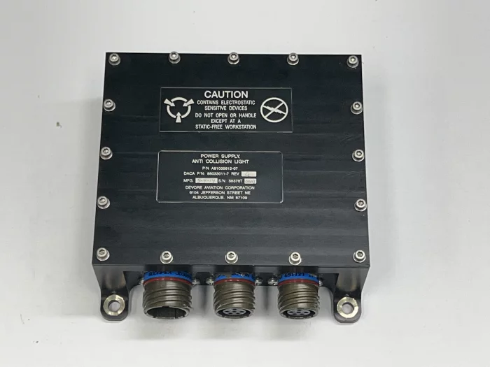
DIGITRON. Co., Ltd.
LIGHT POWER SUPPLY
- Interior/Exterior lighting control device
- Input Power : 28 VDC
- MIL-STD-461
- MIL-STD-704
- RTCA/DO-160 Section 25
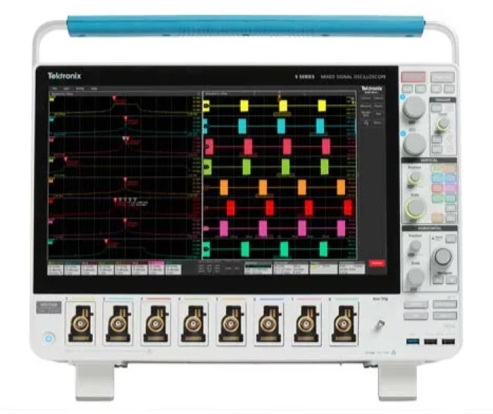
GnK Solution
MSO58B
Mixed Signal Oscilloscope; (8) FlexChannels with 62.5M record length, 1-year warranty, Certificate of Traceable Calibration Standard, (Bandwidth option required)
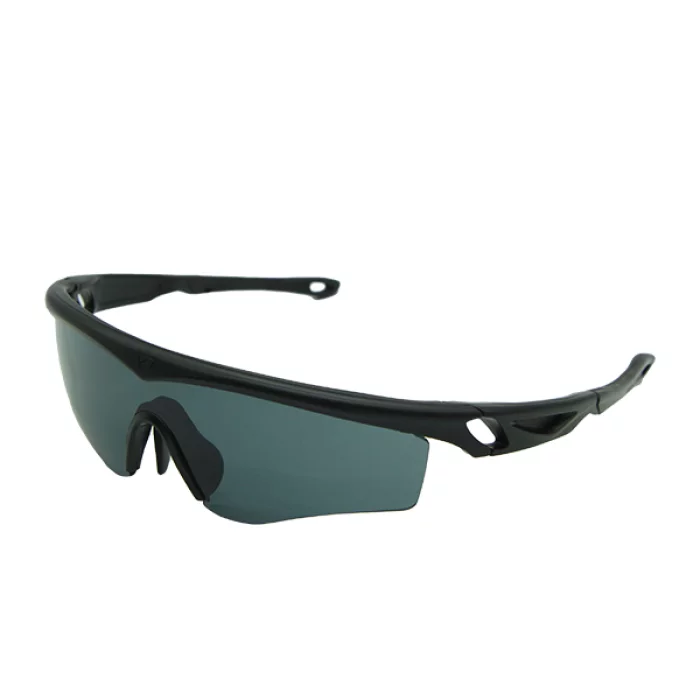
WOOSUNGSITEK
JEFF CONDOR Ballistic Spectacle
JEFF CONDOR is the tactical spectacle for Military & Enforcement who need ultimate protection.
Shape memory alloy gives secure fit & maximum comfort.
JEFF CONDOR is an innovative product that can minimize visual disturbance caused by fogging by applying Anti-Scratch & Anti-Fog coating on the inside and outside of the lenses.
It can offer up to 99.9 protection form UV rays.
It is compliant with ANSI Z87.1 standard requirement, and European CE standard, and exceed U.S Military eyewear ballistic resistance requirement MIL-PRF-32432A.
Thin temples enable compatibility with communication systems and helmets.
ElectroAir
APA-110
APA-110 is designed to eliminate CO2 emissions with its unique technical characteristics. It can perform the complete service of aircraft at remote parking places with diesel engine and it is also capable to operate from the 50/60Hz, 400V, 3 phase main power supply grid as any electrical GPU, without fuel consumption and with zero operating emissions. The range of different APA configurations with no emissions allow for safer, cleaner and more practical operational conditions for operators and personnel at the location.

View page in English


디렉터리 기능
전시회 도우미
In-depth Exhibitor Profiles
Each exhibitor can add as many products and services as they wish, with in-depth information and specifications. This allows buyers to find what they want easily.
Self Provisioning for Exhibitors
Each exhibitor has full control of their content - to edit their company profile, upload products and enter staff details.
방문 계획 수립
북마크 도구와 이벤트 플래너를 사용해 방문하고자 하는 기업과 관심 있는 제품을 검색하세요. 저장한 모든 항목을 조회할 수 있습니다
고급 검색
고급 검색 기능을 사용하여 상품, 인물, 기업의 위치를 빠르게 조회할 수 있습니다. 최첨단 기술을 통해 모든 참가사의 정보를 철저히 스캔하여 세밀하고 관련성 있는 정보를 제공합니다
상호작용 가능 평면도
디렉터리를 사용해 전시회를 손쉽게 둘러보세요. 방문하고자 하는 기업의 위치와, 행사장 내 식당, 화장실, 출입구를 평면도에서 찾을 수 있습니다.
플랫폼 내 메시지
플랫폼 상의 전시 참가사와 관람객에게 직접 연락하여 미팅을 신청하거나 추가 정보를 요청하세요.
최신 콘텐츠
기업, 상품, 뉴스, 이벤트
NIDV
Trade promotion
The NIDV supports its members in both national and international markets in as many ways as possible. From participation in international projects, international trade fair visits to programmes with government support. You can find more information about these initiatives below.
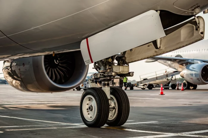
Ho-Ho-Kus, Inc.
Wheels and brakes
Our products include brake clips and brackets.
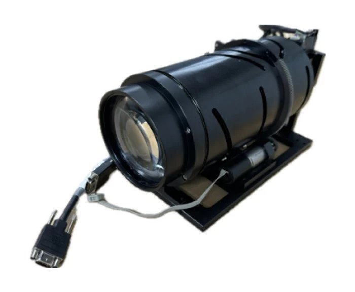
Green Optics Co., Ltd.
Vis/SWIR Zoom Optics
1. Feature
- A common optical system supporting two wavelength bands (visible/SWIR) with a CAM structure, capable of up to 10× magnification.
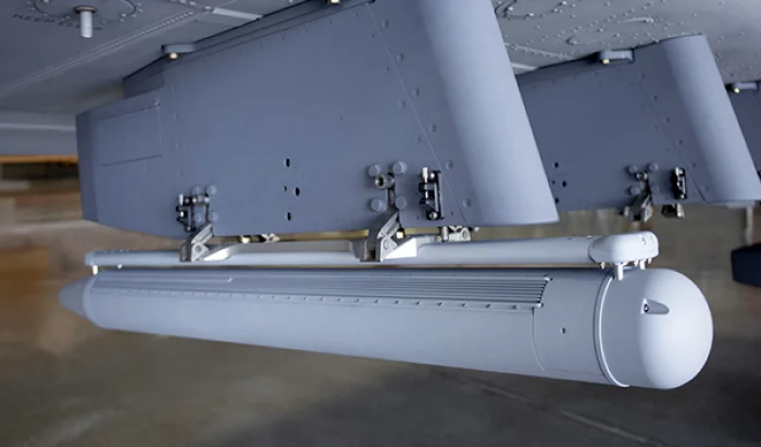
IMSAR LLC
IMSAR NSP-7 flying with Meta Special Aerospace on a Special Missions King Air 350
IMSAR's high performance multi-mode radar integration on Meta Special Aerospace's King Air provides all-weather imaging, monitoring, and surface search capabilities at long ranges and high altitudes. Contact us at 801.798.8440 or sales@imsar.com for more information.