
 Digital Directory
한국어로 페이지 보기
Seoul ADEX 2025 Digital Directory
Plan your trip to Seoul ADEX 2025 using our state of the art Digital Directory
Register in seconds with just your email




Directory Features
To help you at the show
In-depth Exhibitor Profiles
Each exhibitor can add as many products and services as they wish, with in-depth information and specifications. This allows buyers to find what they want easily.
Self Provisioning for Exhibitors
Each exhibitor has full control of their content - to edit their company profile, upload products and enter staff details.
Plan your trip
Use the bookmarking and event planning tool to research the companies you would like to visit and the products you are interested in finding. You will be able to locate all of your saved companies on our floorplan
Advanced Search
Utilize our advanced search function to quickly locate products, people, and companies. Our state-of-the-art technology thoroughly scans all exhibitor information, delivering precise and relevant results
Interactive Floorplan
Navigate the show effortlessly with our directory. Use the floorplan to locate companies you want to visit and to find your way to onsite restaurants, toilets and site entrances and exits.
On-platform Messaging
Reach out to exhibitors and visitors directly on our platform to set up meetings, or request more information.
Some of our latest content
Companies, Products, News, Events

YUAN High-Tech Development Co., Ltd.
The SmartVDO Eye series (AI camera)
The SmartVDO Eye series AI cameras use the NVIDIA® Orin™ NX Super platform, offering a comprehensive, all-in-one AI monitoring solution. The NeuroEye-I series, designed for industrial inspection, features Sony high-resolution, high-sensitivity sensors and supports both rolling and global shutters for capturing detailed, high-quality images. The NeuroEye-S series, built for environmental safety, offers autofocus, auto-aperture, low-light night vision, and IP66 protection, ensuring reliable operation in harsh conditions. Combined with YUAN’s powerful AI development kit, QDEEP, AI models can be rapidly deployed and customized to enhance operational efficiency.
WAVEPIA
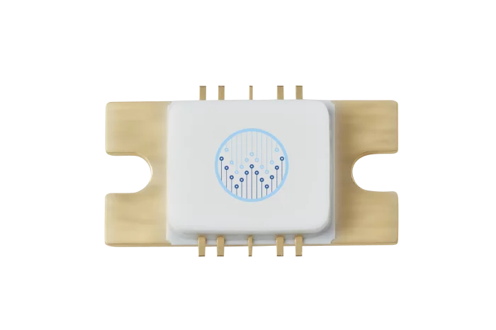
X-band MMIC PA - WPGM0811100M
WPGM0811100M is a 100W Gallium Nitride (GaN) Monolithic Microwave Integrated Circuit (MMIC).
WPGM0811100M is useful for high power X-band Radar applications.
Spec
Frequency : 8-11GHz
Saturated Output Power : 100W@9.5GHz
PAE : 38.7%
Power Gain : 29.5dB@9.5GHz
Operating Voltage : 28-32V

SEMIP CODECHAMP
Magnetic sensors
Magnetic sensors (Hall effect) for air and land applications
fly by wire

GE Aerospace
GE's T901 engine is ready for the future of the US Army rotorcraft aviation
GE's T901 Engine for ITEPA test cell is not a combat mission. In combat, there is no time for an unproven design. With more than 100 million flight hours of ...

View page in English




디렉터리 기능
전시회 도우미
In-depth Exhibitor Profiles
Each exhibitor can add as many products and services as they wish, with in-depth information and specifications. This allows buyers to find what they want easily.
Self Provisioning for Exhibitors
Each exhibitor has full control of their content - to edit their company profile, upload products and enter staff details.
방문 계획 수립
북마크 도구와 이벤트 플래너를 사용해 방문하고자 하는 기업과 관심 있는 제품을 검색하세요. 저장한 모든 항목을 조회할 수 있습니다
고급 검색
고급 검색 기능을 사용하여 상품, 인물, 기업의 위치를 빠르게 조회할 수 있습니다. 최첨단 기술을 통해 모든 참가사의 정보를 철저히 스캔하여 세밀하고 관련성 있는 정보를 제공합니다
상호작용 가능 평면도
디렉터리를 사용해 전시회를 손쉽게 둘러보세요. 방문하고자 하는 기업의 위치와, 행사장 내 식당, 화장실, 출입구를 평면도에서 찾을 수 있습니다.
플랫폼 내 메시지
플랫폼 상의 전시 참가사와 관람객에게 직접 연락하여 미팅을 신청하거나 추가 정보를 요청하세요.
최신 콘텐츠
기업, 상품, 뉴스, 이벤트
Precision Sensors
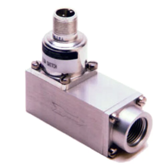
Flow switches
Flow Switches

Honeywell International
By the Numbers: From Spacecraft to Satellites
Every year, we celebrate World Space Week in October to honor scientists' contributions to space research and inspire the next generation of innovators. Honeywell has been a part of every NASA human space mission since the late 1950s, when our flight-control systems were installed on the X-15 Rocket Plane (shown above in a photo of Neil Armstrong after a research flight in November 1959).
EMCORE
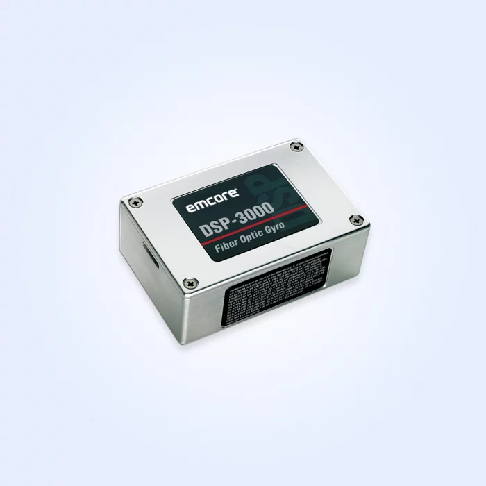
DSP-3000 Fiber Optic Gyro (FOG) (Non-ITAR)
Its compact and robust design, coupled with a choice of analog, digital, and digital RS-232 outputs, makes the DSP-3000 the most versatile fiber optic gyro available and an ideal solution for guidance and stabilization, low-cost IMUs, integrated GPS/INS, and AHRS.
Highlights
EMCORE’s mature all-fiber optical circuit for exceptionally low noise (ARW)
EMCORE’s proprietary E•Core polarization-maintaining fiber
Robust, modular design housed in a package roughly the same size as a deck of playing cards
Technology Details
DSP Technology
EMCORE’s DSP electronics improve FOG performance in critical areas such as scale factor and bias vs. temperature, scale factor linearity, and maximum input rate. EMCORE’s exclusive DSP design is covered by multiple patents* and overcomes the limitations of analog signal processing, eliminating temperature-sensitive drift and rotation errors.
*This product is covered by one or more patents, including U.S. Patent #6,429,939, “DSP Signal Processing for Open Loop Fiber Optic Sensors.”
Feature Options
Two Versatile Variants
If you need a compact FOG with a powerful high-speed RS-422 interface with 1000 Hz asynchronous output, consider the DSP-3100 FOG.
If you require a true RS-422 interface and a 1000 Hz synchronous output in a durable, shielded package, take a look at the DSP-3400.
Young Poong Electronics
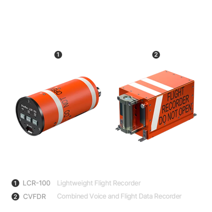
FLIGHT DATA RECORDER
1. The recorded flight and voice data are securely stored on crash-protected memory, both fixed-installed and deployable.
2. This proven FDR with legacy is available for rotary and fixed wings for military but also for civil application like Urban Air Mobility(UAM).
3. It is a All in One recording, Innovation in lightweight solutions,certified by European Airworthiness Certification Authority that secures the aviation safety.