Seoul ADEX 2027 Digital Directory
Plan your trip to Seoul ADEX 2027 using our state of the art Digital Directory
Register in seconds with just your email


Directory Features
To help you at the show
In-depth Exhibitor Profiles
Each exhibitor can add as many products and services as they wish, with in-depth information and specifications. This allows buyers to find what they want easily.
Self Provisioning for Exhibitors
Each exhibitor has full control of their content - to edit their company profile, upload products and enter staff details.
Plan your trip
Use the bookmarking and event planning tool to research the companies you would like to visit and the products you are interested in finding. You will be able to locate all of your saved companies on our floorplan
Advanced Search
Utilize our advanced search function to quickly locate products, people, and companies. Our state-of-the-art technology thoroughly scans all exhibitor information, delivering precise and relevant results
Interactive Floorplan
Navigate the show effortlessly with our directory. Use the floorplan to locate companies you want to visit and to find your way to onsite restaurants, toilets and site entrances and exits.
On-platform Messaging
Reach out to exhibitors and visitors directly on our platform to set up meetings, or request more information.
Some of our latest content
Companies, Products, News, Events
General Atomics Aeronautical Systems, Inc.
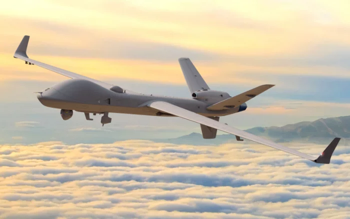
MQ-9B SkyGuardian
MQ-9B SkyGuardian® is the next generation of remotely piloted
aircraft systems (RPAS), delivering persistent intelligence,
surveillance, and reconnaissance (ISR) around the globe.
SkyGuardian is designed to fly over the horizon via satellite for up
to 40 hours in all types of weather and safely integrate into civil
airspace, enabling joint forces and civil authorities to deliver real-time
situational awareness anywhere in the world—day or night. Featuring
a longer wingspan than its predecessors at 79 ft (24 m), the aircraft is
outfitted with the revolutionary Lynx® Multi-mode Radar, an advanced
electro-optical/infrared (EO/IR) sensor, and automatic takeoff and
landing capability. In addition to its industry-leading endurance and
superior surveillance capabilities, SkyGuardian seamlessly integrates
with its users’ other platforms, systems, and podded technologies,
dramatically expanding the aircraft's multi-domain mission set
aircraft systems (RPAS), delivering persistent intelligence,
surveillance, and reconnaissance (ISR) around the globe.
SkyGuardian is designed to fly over the horizon via satellite for up
to 40 hours in all types of weather and safely integrate into civil
airspace, enabling joint forces and civil authorities to deliver real-time
situational awareness anywhere in the world—day or night. Featuring
a longer wingspan than its predecessors at 79 ft (24 m), the aircraft is
outfitted with the revolutionary Lynx® Multi-mode Radar, an advanced
electro-optical/infrared (EO/IR) sensor, and automatic takeoff and
landing capability. In addition to its industry-leading endurance and
superior surveillance capabilities, SkyGuardian seamlessly integrates
with its users’ other platforms, systems, and podded technologies,
dramatically expanding the aircraft's multi-domain mission set
LIG Nex1
surveillance and reconnaissance
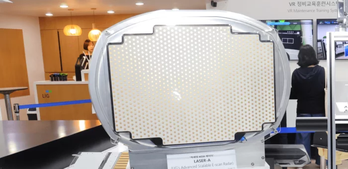
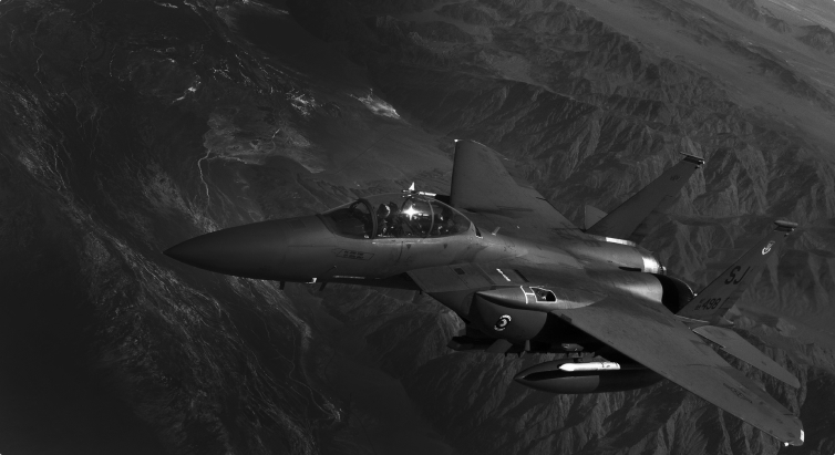
Active phased array fire control radar (AESA) for aircraft
A fire control multi-function radar (MFR) that can simultaneously detect, identify, and track multiple targets, including in the air and on the ground, and has SAR and NCTR functions.
Aircraft (fighter)-mounted AESA radar is a core sensor for fighter jets to perform day/night/all-weather multiple missions. It operates in multiple modes such as air-to-air/air-to-ground/air-to-sea/support mode, and acquires ground images and air/ground in electronic warfare situations. It is essential mission equipment for fighter jets that detects/tracks multiple targets and supports guided missile guidance and gun shooting.

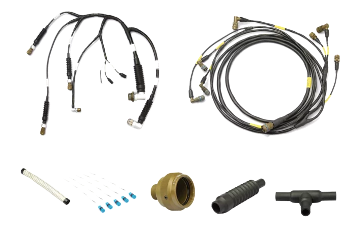
PEI-Genesis
Custom Cable Solutions
Hessed Korea
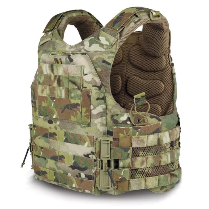
MALE EPIC-DSX ASSAULTER’S PLATE CARRIER
Slim, ergonomic full coverage vest
Taktic buckle system for quick connect & release
Antibacterial/FR treated padded spacer mesh system
Poly mesh cummerbund for increased ventilation
Flush admin chest pocket with internal elastic straps
PALS webbing for MOLLE attachment
Zipper for MV Assaulter's Zip-On Back Panels
Increased structural integrity and reduced rear deformation
Compatible with our entire accessories line
Soft armor included
Composition
Material : 500D Cordura® + ARAMID / PV®
Size :
Small : 8.5" x 11.5" Plate Pocket
Medium : 9.3" x 12.3" Plate Pocket
Large : 10" x 13" Plate Pocket
XLarge : 10.9" x 13.8" Plate Pocket
Colors
MC (MultiCam)
BMC (Black MultiCam)
BK (Black)
RG (Ranger Green)
CYT (Coyote Brown)


.jpg)
_700.webp)