
 Digital Directory
한국어로 페이지 보기
Seoul ADEX 2025 Digital Directory
Plan your trip to Seoul ADEX 2025 using our state of the art Digital Directory
Register in seconds with just your email



Directory Features
To help you at the show
In-depth Exhibitor Profiles
Each exhibitor can add as many products and services as they wish, with in-depth information and specifications. This allows buyers to find what they want easily.
Self Provisioning for Exhibitors
Each exhibitor has full control of their content - to edit their company profile, upload products and enter staff details.
Plan your trip
Use the bookmarking and event planning tool to research the companies you would like to visit and the products you are interested in finding. You will be able to locate all of your saved companies on our floorplan
Advanced Search
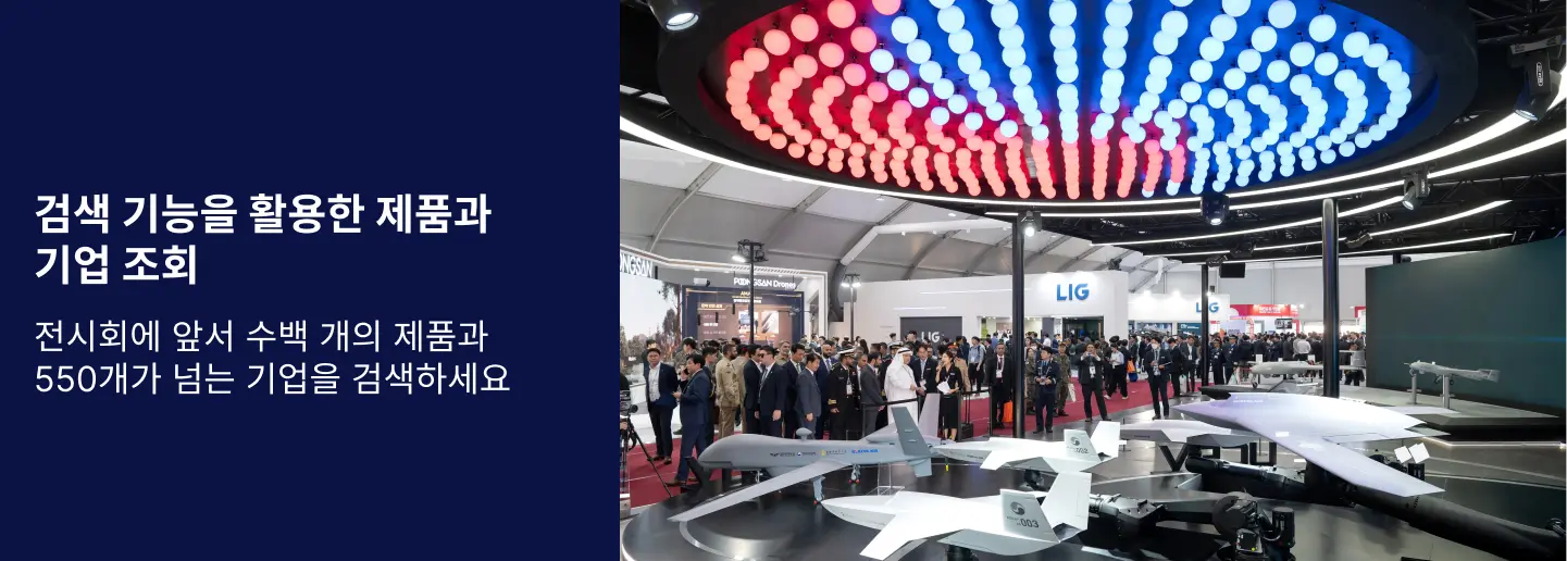
Utilize our advanced search function to quickly locate products, people, and companies. Our state-of-the-art technology thoroughly scans all exhibitor information, delivering precise and relevant results
Interactive Floorplan
Navigate the show effortlessly with our directory. Use the floorplan to locate companies you want to visit and to find your way to onsite restaurants, toilets and site entrances and exits.
On-platform Messaging
Reach out to exhibitors and visitors directly on our platform to set up meetings, or request more information.
Some of our latest content
Companies, Products, News, Events
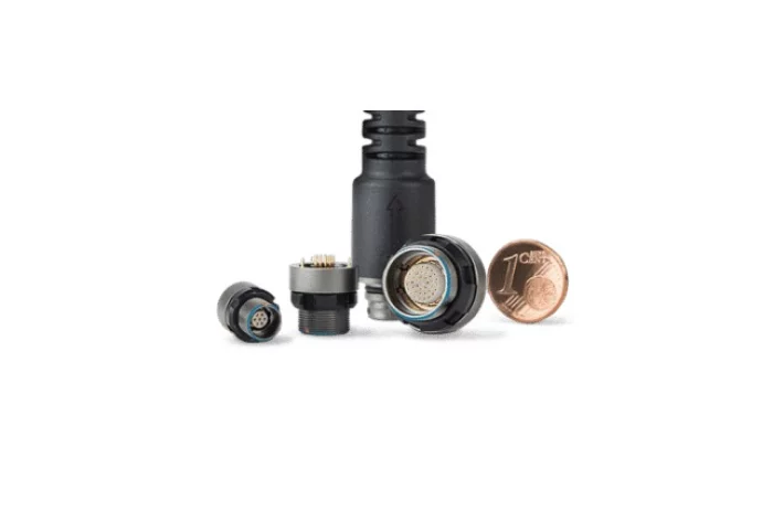
SamTra International
Connectors
Connectors
Seabury Solutions
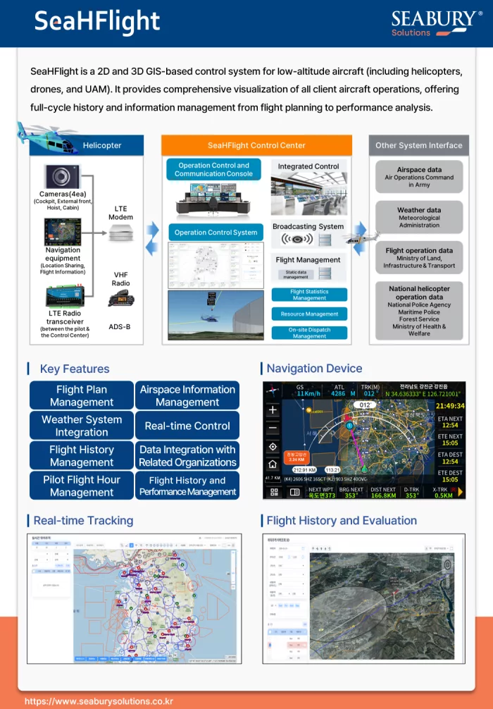
SeaHFlight - Digital Twin System for Low-Altitude Air Control
SeaHFlight is an advanced 2D/3D GIS-based command and control solution engineered for the comprehensive management of low-altitude aircraft, including helicopters, drones, and future UAMs. It provides a complete operational picture, offering full lifecycle management from initial flight planning and real-time monitoring to post-flight performance analysis.
Key Capabilities:
Unified Situational Awareness: Achieve superior decision-making with a dynamic 2D/3D operational map that visualizes all air assets in real-time. The system integrates crucial data layers, including weather, airspace information, and flight plans.
End-to-End Mission Management: Streamline the entire operational workflow, covering everything from flight plan creation and pilot hour management to flight history recording and detailed performance evaluation.
Proven Interoperability: SeaHFlight is designed for seamless data integration with key national and military agencies (Army, Police, National Fire Agency, Forest Service). This creates a unified network for complex, multi-agency public safety or defense operations.
Future-Ready Platform: Built to manage not only current helicopter and drone fleets but also the next generation of Urban Air Mobility (UAM), SeaHFlight is a scalable, long-term solution for modern aviation.
_700.webp)
Augmented Knowledge Corp.
Boeing 737-MAX Training & Education Simulator
Our XR-based aircraft maintenance simulator is officially certified by the Ministry of Land, Infrastructure and Transport (MOLIT) of South Korea for training and education.
It provides specialized training environments for the A321, B737-MAX, and B737-800NG aircraft, featuring over 80 detailed modules—including procedures for engine removal, main landing gear installation, and more.
This subscription-based simulator is fully compatible with smartphones, tablets, and wearable XR devices, enabling seamless access through a cloud-based web service. Users can train anytime, anywhere—perfect for both remote learning and remote maintenance scenarios.
Compared to traditional classroom learning, the XR platform is 4 times more effective and requires only one-third the training time. It also improves user confidence in real-world technical applications by up to 275%.
By transforming traditional paper manuals into immersive, interactive training environments, the simulator delivers the next generation of aircraft MRO education for both civil and defense sectors.
EMCORE
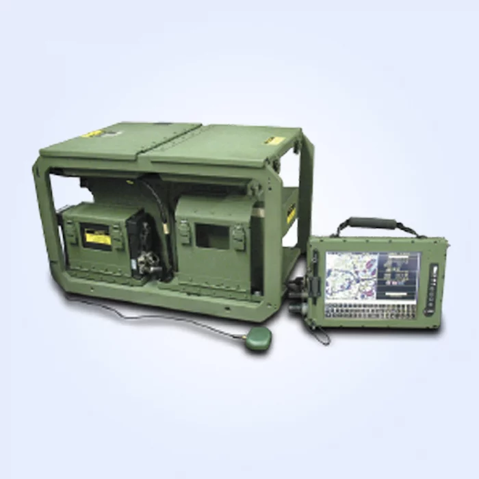
IPADS-I Improved Position and Azimuth Determining System-International
EMCORE’s IPADS-I (International) provides significant enhancements for today’s Army and Marine Corps survey teams. IPADS offers a proven, reliable, lightweight, off-the-shelf solution developed around four main components.
> Compact Position/Navigation Unit (CPNU)
> Control and Display Unit (CDU)
> Battery and Charger Unit (BCU)
> Porro Prism Assembly (PPA)
All components are housed in a robust frame that allows for easy component access and stability, while facilitating a ready, two-person transfer between vehicles and aircraft.
Features
High-precision common survey enables efficient mass fires
Impervious to jamming (inertial mode)
Embedded Selective Availability Anti-Spoofing Module (SAASM) GPS option
Navigation aids (compass rose and digital maps)
In-vehicle and offset survey
Combat-proven
Embedded Built-In Test (BIT)
High reliability MTBF, low mean time to repair (MTTR)
No periodic calibration required
Applications
Artillery Survey to Mark:
Survey Control Point (SCP) position; used to initialize weapon systems
Orienting Line (OL) position and azimuth; used to initialize and align artillery assets
View page in English


디렉터리 기능
전시회 도우미
In-depth Exhibitor Profiles
Each exhibitor can add as many products and services as they wish, with in-depth information and specifications. This allows buyers to find what they want easily.
Self Provisioning for Exhibitors
Each exhibitor has full control of their content - to edit their company profile, upload products and enter staff details.
방문 계획 수립
북마크 도구와 이벤트 플래너를 사용해 방문하고자 하는 기업과 관심 있는 제품을 검색하세요. 저장한 모든 항목을 조회할 수 있습니다
고급 검색
고급 검색 기능을 사용하여 상품, 인물, 기업의 위치를 빠르게 조회할 수 있습니다. 최첨단 기술을 통해 모든 참가사의 정보를 철저히 스캔하여 세밀하고 관련성 있는 정보를 제공합니다
상호작용 가능 평면도
디렉터리를 사용해 전시회를 손쉽게 둘러보세요. 방문하고자 하는 기업의 위치와, 행사장 내 식당, 화장실, 출입구를 평면도에서 찾을 수 있습니다.
플랫폼 내 메시지
플랫폼 상의 전시 참가사와 관람객에게 직접 연락하여 미팅을 신청하거나 추가 정보를 요청하세요.
최신 콘텐츠
기업, 상품, 뉴스, 이벤트
-jpg_700.webp)
XMW Inc.
Satcom Transmitter/Receiver(Air Series)
It is a product lineup that is proven in global markets and has world-class competitiveness.
And it is being exported to more than 20 countries around the world.
MTG
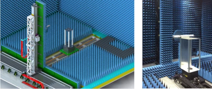
Near-Field Measurement System
Near-field Ranges calculate Far-field pattern based on amplitudes and phase samples in radiating near-field region mathematically. Near-field Ranges have various testing configurations-planar, cylindrical and spherical. Planar Near-field range is suitable for directional antennas. Cylindrical Near-field range is suitable for antennas with wide side/back lobes and fan beam antennas. Spherical Near-field Range is suitable for any type of antennas. You can choose reasonably defending your conditions. MTG has many experience supplying Far-field ranges as well as Near-field ranges. MTG work with many companies including munitions industries, laboratories, telecommunication corporations, and antenna corporations. We can provide a series of positioner, probes and Near-field measurement software.
.jpg)
ABC Essais
Services - ABC Essais
Maintenance Increase security and productivity to reduce costs and minimize downtime. Willing to provide our customers with high-performance technical assistance, we offer scheduled and unplanned maintenance interventions, as well as periodic verification of measurement channels using our calibration equipments. Our systems allow us to perform these operations internally or at our customers site.

IMSAR LLC
NSP-7 - IMSAR
The NSP-7 combines IMSAR’s typical reliability with increased capabilities: for example, the ability to detect footprints. It can even perform SAR Motion Video (SMV) when paired with an airborne server.
The IMSAR NSP-7 radar system is a high-performance, weatherized radar pod engineered for long-range Intelligence, Surveillance, and Reconnaissance (ISR) and maritime/ground surveillance missions. With advanced Synthetic Aperture (SAR) and Moving Target Indication (MTI) capabilities, the NSP-7 delivers exceptional imaging and detection in a rugged, low-SWaP (Size, Weight, and Power) package.