
 Digital Directory
한국어로 페이지 보기
Seoul ADEX 2025 Digital Directory
Plan your trip to Seoul ADEX 2025 using our state of the art Digital Directory
Register in seconds with just your email

Directory Features
To help you at the show
In-depth Exhibitor Profiles
Each exhibitor can add as many products and services as they wish, with in-depth information and specifications. This allows buyers to find what they want easily.
Self Provisioning for Exhibitors
Each exhibitor has full control of their content - to edit their company profile, upload products and enter staff details.
Plan your trip
Use the bookmarking and event planning tool to research the companies you would like to visit and the products you are interested in finding. You will be able to locate all of your saved companies on our floorplan
Advanced Search
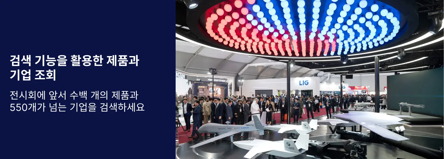
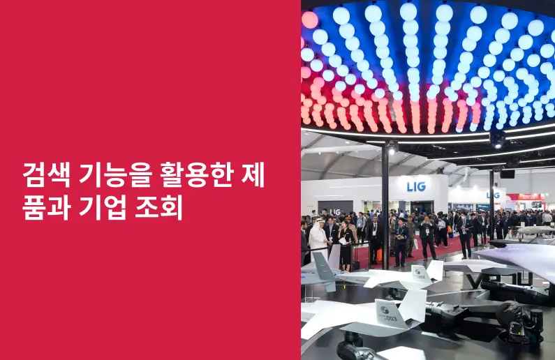
Utilize our advanced search function to quickly locate products, people, and companies. Our state-of-the-art technology thoroughly scans all exhibitor information, delivering precise and relevant results
Interactive Floorplan
Navigate the show effortlessly with our directory. Use the floorplan to locate companies you want to visit and to find your way to onsite restaurants, toilets and site entrances and exits.
On-platform Messaging
Reach out to exhibitors and visitors directly on our platform to set up meetings, or request more information.
Some of our latest content
Companies, Products, News, Events
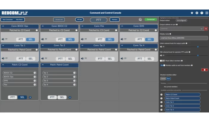
REDCOM Laboratories, Inc.
REDCOM Sigma® C2 Console
REDCOM Sigma® C2 Console is a powerful app that provides operators with a single pane of glass to monitor and control all communications within the tactical C2 network, including both SIP and radio endpoints. The REDCOM C2 Console is browser-based and runs on any PC, laptop, or tablet.
NeXber Co., Ltd.
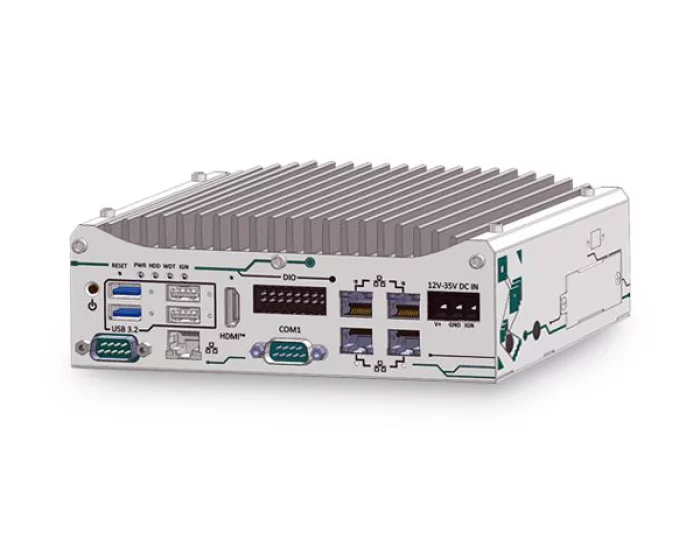
POC-960GC
Compact GPU Computer
AMD® Ryzen™ 8640U processor with 6 cores and 12 threads
Supports entry level low-profile GPU card
Supports up to 32GB DDR5-5600
4x optional PoE+, 1x 2.5GbE and 4x USB3.2 ports
1x M.2 2280 NVMe for storage and 2x Mini-PCIe sockets
-25°C to 60°C temperature operation
12V to 35V DC input with optional ignition power control
ACEWAVETECH
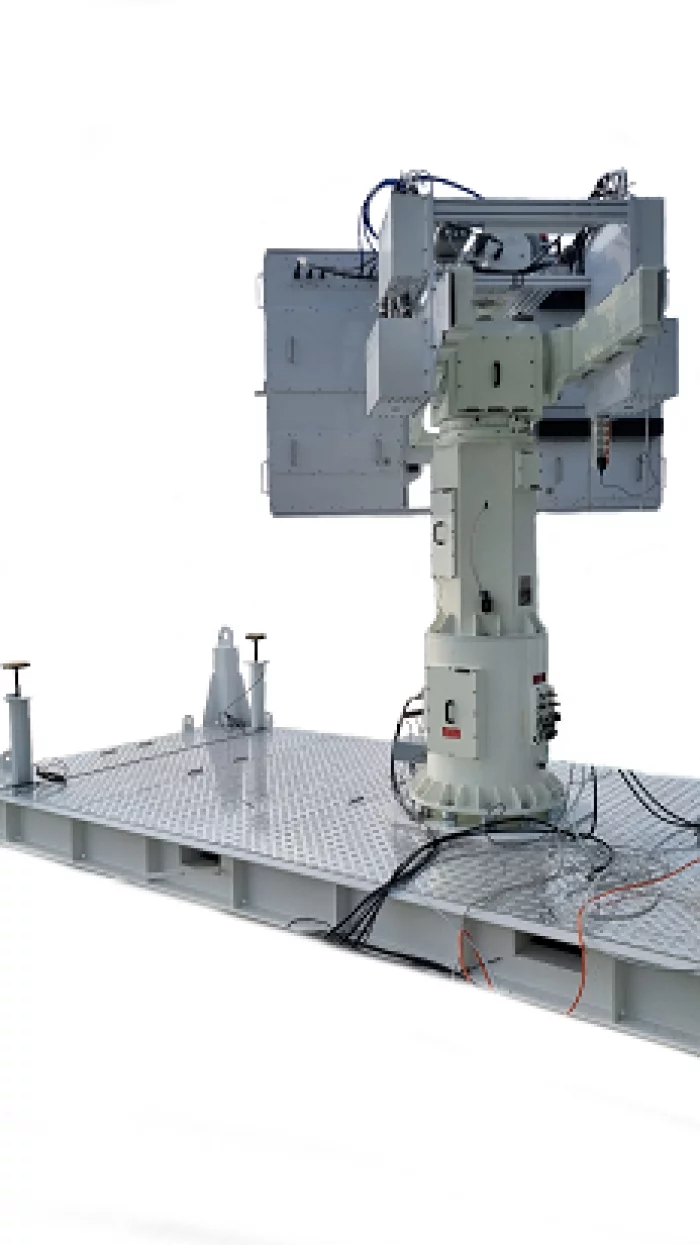
Doppler Tracking System
- Provides accurate measurements of the trajectories of aircraft, guided weapons, separation of aircraft, and target encounters.
- Using CW and FMCW
EMCORE
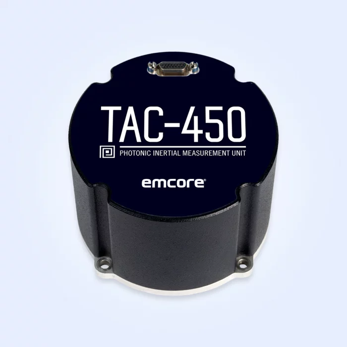
TAC-450-360 Photonic Inertial Measurement Unit (IMU) (Non-ITAR)
Designed to deliver the highest level of performance, the non-ITAR TAC-450-360 IMU includes our exclusive photonic integrated chip (PIC) technology. The high-performance TAC-450-360 IMU is designed for applications in which high bandwidth, low latency, and low drift are critical. The TAC-450-360 IMU is integrated with inertial-grade accelerometers and three axes of magnetometers to provide the high accuracy levels that leading autonomous and manned platforms demand.
Highlights
Designed for ease of integration with flexible interface settings and programmable message outputs
Excellent performance in critical applications and the specs that matter most
Improved SWaP plus robust performance and survivability
Technology Details
Photonic Integrated Chip Technology
EMCORE’s photonic integrated chip (PIC) technology* reimagines FOG technology by replacing individual fiber components with an innovative integrated planar optic chip. This results in a FOG with PIC Inside™ that’s reliable and robust. With three of these integrated photonic gyros at its core, the TAC-450-360 IMU provides the safe, accurate performance autonomous platforms demand.
View page in English

디렉터리 기능
전시회 도우미
In-depth Exhibitor Profiles
Each exhibitor can add as many products and services as they wish, with in-depth information and specifications. This allows buyers to find what they want easily.
Self Provisioning for Exhibitors
Each exhibitor has full control of their content - to edit their company profile, upload products and enter staff details.
방문 계획 수립
북마크 도구와 이벤트 플래너를 사용해 방문하고자 하는 기업과 관심 있는 제품을 검색하세요. 저장한 모든 항목을 조회할 수 있습니다
고급 검색
고급 검색 기능을 사용하여 상품, 인물, 기업의 위치를 빠르게 조회할 수 있습니다. 최첨단 기술을 통해 모든 참가사의 정보를 철저히 스캔하여 세밀하고 관련성 있는 정보를 제공합니다
상호작용 가능 평면도
디렉터리를 사용해 전시회를 손쉽게 둘러보세요. 방문하고자 하는 기업의 위치와, 행사장 내 식당, 화장실, 출입구를 평면도에서 찾을 수 있습니다.
플랫폼 내 메시지
플랫폼 상의 전시 참가사와 관람객에게 직접 연락하여 미팅을 신청하거나 추가 정보를 요청하세요.
최신 콘텐츠
기업, 상품, 뉴스, 이벤트
_700.webp)
HANMI HYDRAULIC MACHINERY CO., LTD.
Cylinder Lubricator Unit - Everllence
This system product is a product that directly supplies and heats lubricant oil for smooth operation of the main engine cylinder’s metallic and mechanical movement.
Lubricator, a product that supplies lubrication directly to the main engine cylinder liner, can control injection timing and consumption using an electronic control method that responds to the movement of the main engine piston. The alpha lubricator system is based on an algorithm controlling the cylinder oil dosage proportionally to the sulphur content in the fuel and, fuel consumption on particular load of engine. Minimum cylinder oil dosage is required to provide an adequate oil film and detergency properties.
Everllence and WIN GD engines are currently applying the second generation Lubricator type, the Everllence type is Mk-I and the WIN GD type is Mk-ε (Epsilon).
Aeroforce Logistics, LLC
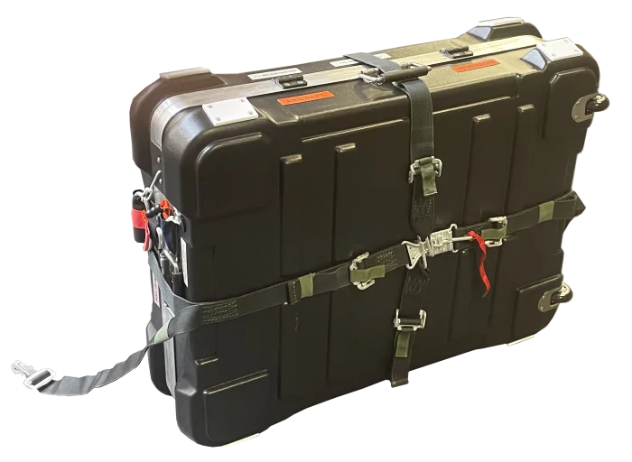
HARD-20 Life Raft System
The HARD-20 Life Raft System is designed to provide maximum protection of the on-board life raft. The system is attached to the aircraft with a bulkhead mount and single-point release harness, enabling deployment by one person. Activation of the system is accomplished via static line mounted to the airframe or manually by a survivor in the water.
Tescan Group a.s.
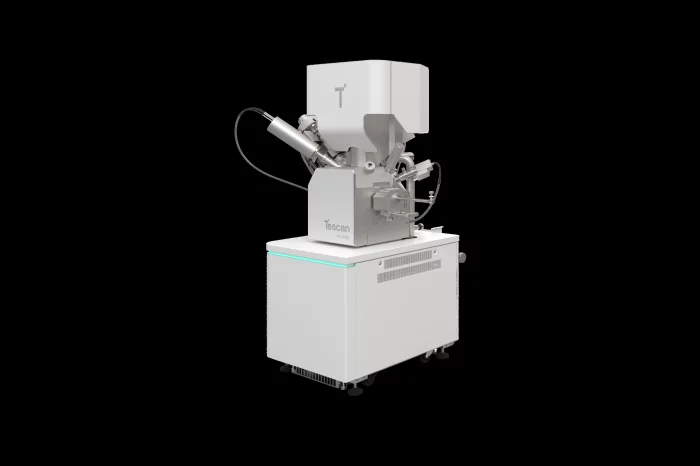
TESCAN SOLARIS 2
TESCAN SOLARIS is a fully automated sample prep platform optimized for advanced devices with sub-10 nm features. It integrates the Triglav™ SEM, AutoTEM Pro™ software, and OptiLift™ nanomanipulator to enable hands-free, repeatable lamella prep in planar, inverted, or top-down geometries.
HANMI HYDRAULIC MACHINERY CO., LTD.
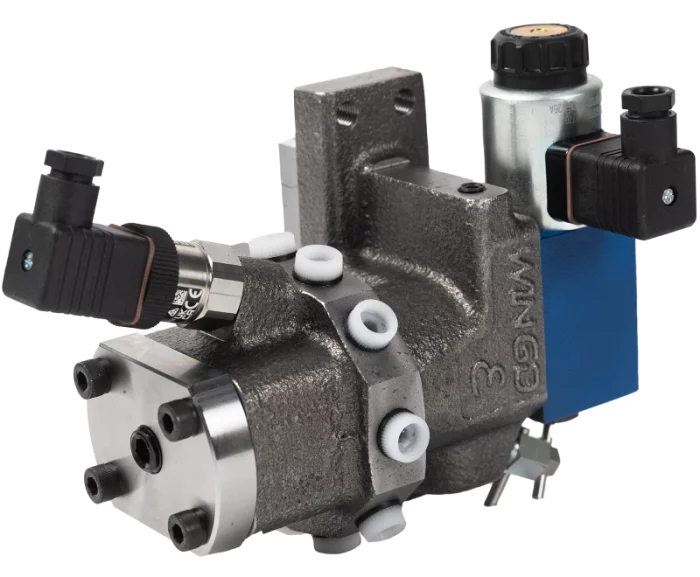
Cylinder Lubricating Pump - WIN GD
This system product is a product that directly supplies and heats lubricant oil for smooth operation of the main engine cylinder’s metallic and mechanical movement.
Lubricator, a product that supplies lubrication directly to the main engine cylinder liner, can control injection timing and consumption using an electronic control method that responds to the movement of the main engine piston. The alpha lubricator system is based on an algorithm controlling the cylinder oil dosage proportionally to the sulphur content in the fuel and, fuel consumption on particular load of engine. Minimum cylinder oil dosage is required to provide an adequate oil film and detergency properties.
Everllence and WIN GD engines are currently applying the second generation Lubricator type, the Everllence type is Mk-I and the WIN GD type is Mk-ε (Epsilon).