한국어로 페이지 보기
Seoul ADEX 2025 Digital Directory
Plan your trip to Seoul ADEX 2025 using our state of the art Digital Directory
Register in seconds with just your email


Directory Features
To help you at the show
In-depth Exhibitor Profiles
Each exhibitor can add as many products and services as they wish, with in-depth information and specifications. This allows buyers to find what they want easily.
Self Provisioning for Exhibitors
Each exhibitor has full control of their content - to edit their company profile, upload products and enter staff details.
Plan your trip
Use the bookmarking and event planning tool to research the companies you would like to visit and the products you are interested in finding. You will be able to locate all of your saved companies on our floorplan
Advanced Search
Utilize our advanced search function to quickly locate products, people, and companies. Our state-of-the-art technology thoroughly scans all exhibitor information, delivering precise and relevant results
Interactive Floorplan
Navigate the show effortlessly with our directory. Use the floorplan to locate companies you want to visit and to find your way to onsite restaurants, toilets and site entrances and exits.
On-platform Messaging
Reach out to exhibitors and visitors directly on our platform to set up meetings, or request more information.
Some of our latest content
Companies, Products, News, Events
Augmented Knowledge Corp.
Airbus A321neo Training & Education Simulator
Our XR-based aircraft maintenance simulator is officially certified by the Ministry of Land, Infrastructure and Transport (MOLIT) of South Korea for training and education.
It provides specialized training environments for the A321, B737-MAX, and B737-800NG aircraft, featuring over 80 detailed modules—including procedures for engine removal, main landing gear installation, and more.
This subscription-based simulator is fully compatible with smartphones, tablets, and wearable XR devices, enabling seamless access through a cloud-based web service. Users can train anytime, anywhere—perfect for both remote learning and remote maintenance scenarios.
Compared to traditional classroom learning, the XR platform is 4 times more effective and requires only one-third the training time. It also improves user confidence in real-world technical applications by up to 275%.
By transforming traditional paper manuals into immersive, interactive training environments, the simulator delivers the next generation of aircraft MRO education for both civil and defense sectors.
Teledyne FLIR LLC
Border Coastal Surveillance Brochure US
Border security and coastal surveillance are 24/7 operations that can’t afford downtime
or periods of reduced readiness. Guarding against illegal immigration, smuggling, and
terrorism demands reliable long-range threat detection and positive identification of
potential threats all day, all night, and in all conditions.
Kallman Worldwide, Inc.
Kallman Creative Services
Build Confidence from the ground up! Your partner for custom built exhibits - any trade show, anywhere in the world. From the initial brief to the last detail, our approach is simple: we’re hands-on partners and honest collaborators who listen, design, and build to your specifications — on strategy, on time, on budget.
Turn heads with a custom-built exhibit from Kallman Creative Services. Take pride in owning an event destination that stops visitors in their tracks and jump-starts sales conversations.
Custom Builds - Chalets - Pavilions - Corporate Events
Ultronics
TAC-450 IMU
The new TAC-450-320/340/360 inertial measurement unit (IMU) is a dependable, tactical-grade, non-ITAR inertial system that’s also affordable. It features EMCORE’s exclusive photonic integrated chip (PIC) technology for robust performance and survivability and offers inertial-grade MEMS accelerometers for outstanding FOG-based inertial performance as affordable as MEMS alternatives. The TAC-450-320/340/360 IMU is ideal for autonomous and unmanned commercial and defense applications, mobile mapping and surveying systems, targeting and pointing systems, and guidance and positioning.
Highlights
Compact and lightweight with high-performance
Offered with 16g inertial-grade MEMS accelerometer
Robust performance with high bandwidth
Technology Details
Photonic Integrated Chip Technology
EMCORE’s photonic integrated chip (PIC) technology reimagines FOG technology by replacing individual fiber components with an innovative integrated planar optic chip. This results in a FOG with PIC Inside™ that’s reliable and robust. With three of these integrated photonic gyros at its core, the TAC-450-320/340/360 IMU provides the safe, accurate performance autonomous platforms demand.
State-of-the-art Electronics
EMCORE’s Dual Core DSP electronics with ARM processor require less power for extended product life and offer higher speed with integrated multi-channel processing. Low-loss optical circuits use less light for greater efficiency.
Feature Options
Developer’s Kit for Rapid Integration
The FOG/IMU Developer’s Kit includes easy-to-use software that accelerates your IMU and FOG integration, development, and interface efforts.
View page in English


디렉터리 기능
전시회 도우미
In-depth Exhibitor Profiles
Each exhibitor can add as many products and services as they wish, with in-depth information and specifications. This allows buyers to find what they want easily.
Self Provisioning for Exhibitors
Each exhibitor has full control of their content - to edit their company profile, upload products and enter staff details.
방문 계획 수립
북마크 도구와 이벤트 플래너를 사용해 방문하고자 하는 기업과 관심 있는 제품을 검색하세요. 저장한 모든 항목을 조회할 수 있습니다
고급 검색
고급 검색 기능을 사용하여 상품, 인물, 기업의 위치를 빠르게 조회할 수 있습니다. 최첨단 기술을 통해 모든 참가사의 정보를 철저히 스캔하여 세밀하고 관련성 있는 정보를 제공합니다
상호작용 가능 평면도
디렉터리를 사용해 전시회를 손쉽게 둘러보세요. 방문하고자 하는 기업의 위치와, 행사장 내 식당, 화장실, 출입구를 평면도에서 찾을 수 있습니다.
플랫폼 내 메시지
플랫폼 상의 전시 참가사와 관람객에게 직접 연락하여 미팅을 신청하거나 추가 정보를 요청하세요.
최신 콘텐츠
기업, 상품, 뉴스, 이벤트
SAFRAN
SKYNAUTE
SkyNaute™ hybrid inertial/GNSS navigation system meets all the safety and reliability requirements for airplanes, helicopters and drones. Thanks to the HRG Crystal™, SkyNaute™ is the most competitive aeronautical navigation system on the market.
The best in safe performance
SkyNaute™ Inertial Navigation System relies on mature and proven technologies such as HRG Crystal™ Hemispherical Resonator Gyroscopes. Combining high performance and integrity in all circumstances, SkyNaute™ shows exceptional physical features compared to competing INS with similar performance.
Telcom International
Amphenol Canada
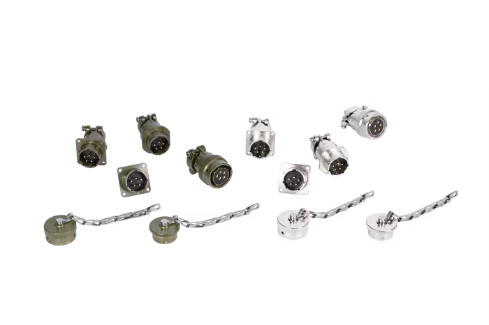
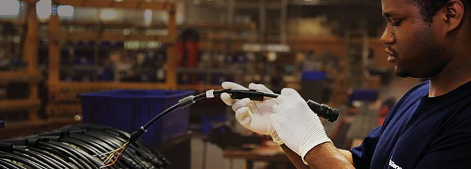
Amphenol CANADA, part of the Amphenol Military Aerospace Operations (AMAO) group, is a global leader with over 50 years of experience in providing customized solutions for customers through design, manufacturing, and testing of rectangular interconnects applicable to military/aerospace and commercial applications.
As a vertical integration company, we have full-scale facilities for design, manufacturing, and testing, enabling us to provide customized solutions tailored to each application.
As a vertical integration company, we offer customers a competitive advantage by reducing costs through shorter lead times.
We can also perform testing tailored to customer specifications.
Seabury Solutions
Alkym - Aviation MRO Solution
Alkym is a world-leading, agile, and flexible MRO/M&E and Asset Management software, specifically designed to significantly improve the performance of aviation operations. It provides a robust, integrated suite that eliminates the need for fragmented systems, offering comprehensive control from technical aspects to regulatory compliance.
Alkym integrates seamlessly with Finance, HR, Payroll, and legacy systems, ensuring a full-suite solution, not just a specific tool. It empowers aviation businesses to achieve greater efficiency, flexibility, and operational performance, transforming maintenance into a strategic asset.
BAE Systems
GPS Products
The Global Positioning System, or GPS, is a navigation and surveillance system that utilizes signals from orbiting satellites. GPS operates independently of internet or telephone reception and can work anywhere on or near Earth where there is a direct line of sight to satellites. With military, civilian, and commercial applications, GPS is a powerful tool for communication, navigation, emergency services, and more.
Digital Directory