한국어로 페이지 보기
Seoul ADEX 2025 Digital Directory
Plan your trip to Seoul ADEX 2025 using our state of the art Digital Directory
Register in seconds with just your email


Directory Features
To help you at the show
In-depth Exhibitor Profiles
Each exhibitor can add as many products and services as they wish, with in-depth information and specifications. This allows buyers to find what they want easily.
Self Provisioning for Exhibitors
Each exhibitor has full control of their content - to edit their company profile, upload products and enter staff details.
Plan your trip
Use the bookmarking and event planning tool to research the companies you would like to visit and the products you are interested in finding. You will be able to locate all of your saved companies on our floorplan
Advanced Search
Utilize our advanced search function to quickly locate products, people, and companies. Our state-of-the-art technology thoroughly scans all exhibitor information, delivering precise and relevant results
Interactive Floorplan
Navigate the show effortlessly with our directory. Use the floorplan to locate companies you want to visit and to find your way to onsite restaurants, toilets and site entrances and exits.
On-platform Messaging
Reach out to exhibitors and visitors directly on our platform to set up meetings, or request more information.
Some of our latest content
Companies, Products, News, Events

Honeywell International
How The Aviation Industry Can Recover Post-Pandemic
The aviation industry was hit hard by the COVID-19 pandemic and is only now beginning to recover. We convened industry leaders from Honeywell Aerospace and asked what carriers can expect in the short-to-midterm as they emerge from the downturn.
YUAN High-Tech Development Co., Ltd.
MIL6N0 IGX 700
NVIDIA IGX is a cutting-edge AI platform delivering high-performance, secure, and reliable computing. Built on autonomous-driving expertise, it supports industrial automation and medical devices, with PCIe expansion for extra vision inputs and full-stack enterprise-grade software and long-term support.
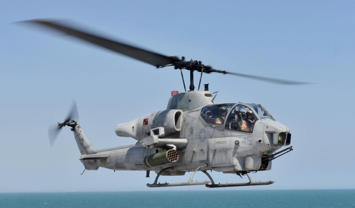
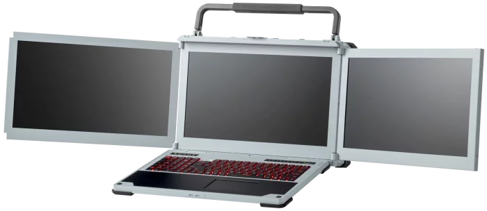
Integrated Procurement Technologies
AH-1 Cobra
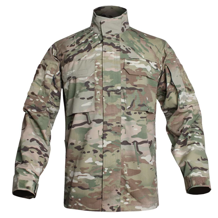
Hessed Korea
109 FIELD SHIRT
NO MELT, NO DRIP (50/50 NYLON COTTON)
Incorporated ventilation system and COOLMAX & Mesh fabrics to ensure comfort and breathability
Multi-pattern round processing for free movement
Velcro® webbing for MOLLE attachment to support scalability
Chest and sleeve side pockets to improve storage convenience
Use MIL-SPEC threads and YKK zippers
Composition
Material : NYLON 50% / COTTON 50%, COOLMAX, MESH
Size : 95~115
Colors
MC (MultiCam)
BMC (Black MultiCam)
BK (Black)
RG (Ranger Green)
CYT (Coyote Brown)

View page in English


디렉터리 기능
전시회 도우미
In-depth Exhibitor Profiles
Each exhibitor can add as many products and services as they wish, with in-depth information and specifications. This allows buyers to find what they want easily.
Self Provisioning for Exhibitors
Each exhibitor has full control of their content - to edit their company profile, upload products and enter staff details.
방문 계획 수립
북마크 도구와 이벤트 플래너를 사용해 방문하고자 하는 기업과 관심 있는 제품을 검색하세요. 저장한 모든 항목을 조회할 수 있습니다
고급 검색
고급 검색 기능을 사용하여 상품, 인물, 기업의 위치를 빠르게 조회할 수 있습니다. 최첨단 기술을 통해 모든 참가사의 정보를 철저히 스캔하여 세밀하고 관련성 있는 정보를 제공합니다
상호작용 가능 평면도
디렉터리를 사용해 전시회를 손쉽게 둘러보세요. 방문하고자 하는 기업의 위치와, 행사장 내 식당, 화장실, 출입구를 평면도에서 찾을 수 있습니다.
플랫폼 내 메시지
플랫폼 상의 전시 참가사와 관람객에게 직접 연락하여 미팅을 신청하거나 추가 정보를 요청하세요.
최신 콘텐츠
기업, 상품, 뉴스, 이벤트
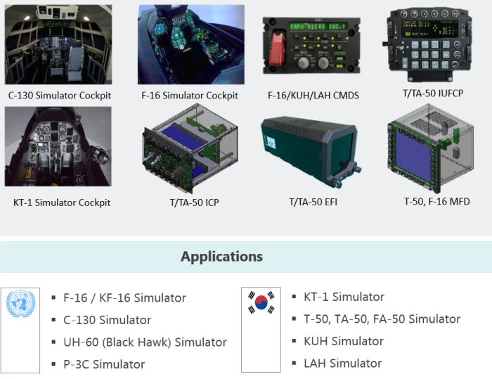
CAPHMICRO Inc.
Aircraft Simulated Panels
We have participated in almost all simulator projects for military aircraft currently in operation in the Republic of Korea (KT-1, KF-16, T-50, FA-50, TA-50, KUH, LAH, KF-21, C-130, etc.), and we produce everything in-house, from mechanism, battlefield, circuit, and firmware design to assembly and testing, using our own personnel and facilities.
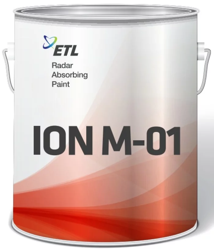
ETL Co., Ltd.
ION M-01
Features
- Excellent absorption performance (Max: -25 dB, Avg: -10 dB)
- Withstands 00 minutes at 000 °C
- Easily applicable to complex structures, including curved surfaces, gaps, and protrusions
- Low dry density and specific gravity
- Reduced number of coating layers (improving workability)
- Passed environmental resistance and durability tests according to the operating conditions of guided missiles.
- Insulating properties to minimize the effects of lightning
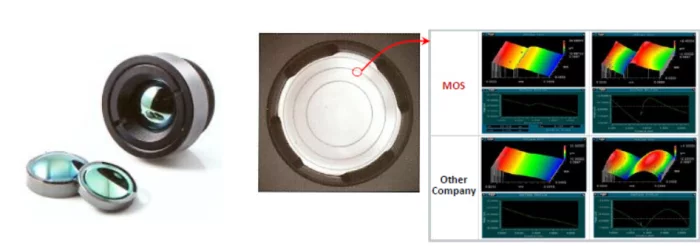
Millenium Optical System (MOS)
Optical System & Module
Precision Molded LWIR lenses using Chalcogenide glass
"High-Volume & Cost Effective Manufacturing"
High performance Diffractive-Aspheric LWIR(@8~12μm) lenses Athermalized Fixed Focus: FL 8.1, 15, 18mm / F# 1.0
High Efficiency AR(Anti-Reflective) Coating Technique for LWIR
Applications: Thermal Imaging and Thermography
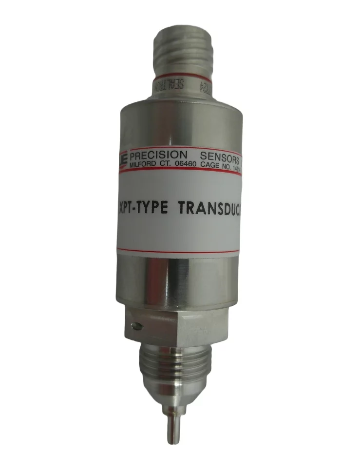
Precision Sensors
XPT series Pressure/temperature transducer
Dual function pressure and temperature transducer