한국어로 페이지 보기
Seoul ADEX 2025 Digital Directory
Plan your trip to Seoul ADEX 2025 using our state of the art Digital Directory
Register in seconds with just your email


Directory Features
To help you at the show
In-depth Exhibitor Profiles
Each exhibitor can add as many products and services as they wish, with in-depth information and specifications. This allows buyers to find what they want easily.
Self Provisioning for Exhibitors
Each exhibitor has full control of their content - to edit their company profile, upload products and enter staff details.
Plan your trip
Use the bookmarking and event planning tool to research the companies you would like to visit and the products you are interested in finding. You will be able to locate all of your saved companies on our floorplan
Advanced Search
Utilize our advanced search function to quickly locate products, people, and companies. Our state-of-the-art technology thoroughly scans all exhibitor information, delivering precise and relevant results
Interactive Floorplan
Navigate the show effortlessly with our directory. Use the floorplan to locate companies you want to visit and to find your way to onsite restaurants, toilets and site entrances and exits.
On-platform Messaging
Reach out to exhibitors and visitors directly on our platform to set up meetings, or request more information.
Some of our latest content
Companies, Products, News, Events
_700.webp)
IR Robot Co.,Ltd.
mightyZAP 17Lf series micro linear servo actuators
- Compact size with built-in drive, position sensor, DC motor and gear box
- Better durability & faster speed under similar rated load comparing to 12Lf series thanks to the bigger 17mm diameter DC motor
- Position, current and speed control along with position & current feedback
- Easy digital extended I/O control through 4 x Expansion I/O ports (No coding)
- 27/37/50/87mm(*) stroke option
(*): Each 3mm stroke can be added when adjusting the long stroke limit through Total Manager software.
Rated load of 17N~70N depending on the lead angle for each stroke
(Speed is inversely proportional to the rated load, so the higher the rated load, the slower the speed.)
- RS-485 MODBUS-RTU protocol applied (IR open protocol is not provided)
- Action feature which enables user’s motion save & run
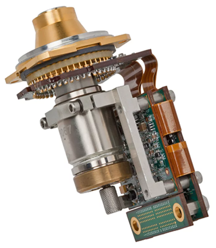
SCD - Semi Conductor Devices
Pelican-D JT
PELICAN-D JT is a MWIR detector for missile applications. The FPA is InSb based, having digital
Readout Integrated Circuit (ROIC) in a format of 640 x 512 with 15μm pitch. Pelican-D JT has a unique structure of Dewar which enables very fast cool down time and hence quick mission readiness using Joule-Thomson (JT) cooler. Due to the low heat load on the focal plane, the detector achieves long mission duration. The Detector can be supplied with a proximity
board which provides Camera Link interface to the customer system. This highly simplifies the
integration of the detector to the system.

Vitzro Cell
Facial Mask (Thin Film Battery) CF30P8035
We lead the latest technology trends with innovations in design and thickness.
VITZROCELL's Thin film batteries are thin and flexible sheet-type batteries with various shapes and thicknesses.
AIR COST CONTROL
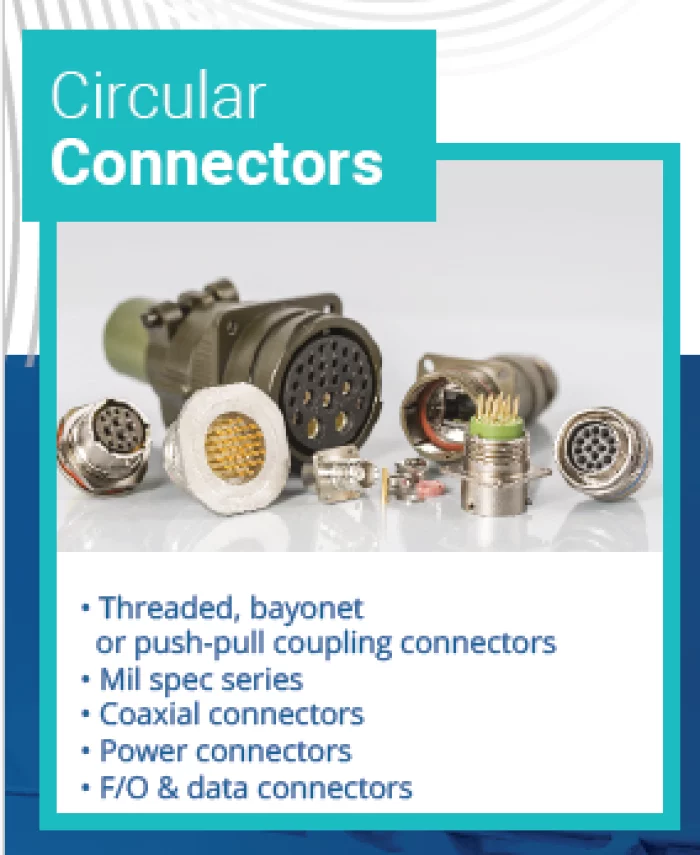
Circular Connectors
• Threaded, bayonet
or push-pull coupling connectors
• Mil spec series
• Coaxial connectors
• Power connectors
• F/O & data connectors

View page in English


디렉터리 기능
전시회 도우미
In-depth Exhibitor Profiles
Each exhibitor can add as many products and services as they wish, with in-depth information and specifications. This allows buyers to find what they want easily.
Self Provisioning for Exhibitors
Each exhibitor has full control of their content - to edit their company profile, upload products and enter staff details.
방문 계획 수립
북마크 도구와 이벤트 플래너를 사용해 방문하고자 하는 기업과 관심 있는 제품을 검색하세요. 저장한 모든 항목을 조회할 수 있습니다
고급 검색
고급 검색 기능을 사용하여 상품, 인물, 기업의 위치를 빠르게 조회할 수 있습니다. 최첨단 기술을 통해 모든 참가사의 정보를 철저히 스캔하여 세밀하고 관련성 있는 정보를 제공합니다
상호작용 가능 평면도
디렉터리를 사용해 전시회를 손쉽게 둘러보세요. 방문하고자 하는 기업의 위치와, 행사장 내 식당, 화장실, 출입구를 평면도에서 찾을 수 있습니다.
플랫폼 내 메시지
플랫폼 상의 전시 참가사와 관람객에게 직접 연락하여 미팅을 신청하거나 추가 정보를 요청하세요.
최신 콘텐츠
기업, 상품, 뉴스, 이벤트
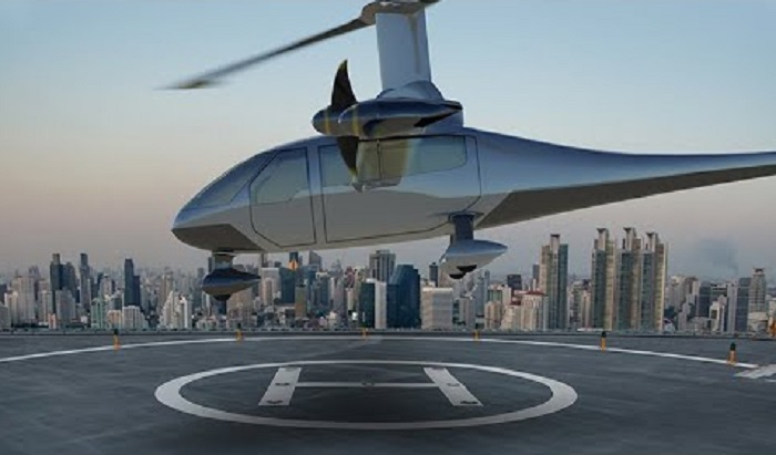
BAE Systems
Energizing the Future of Flight l BAE Systems
BAE Systems is transforming the future of flight with solutions to enable hybrid and all-electric powered aircraft. We bring decades of demonstrated cross do...
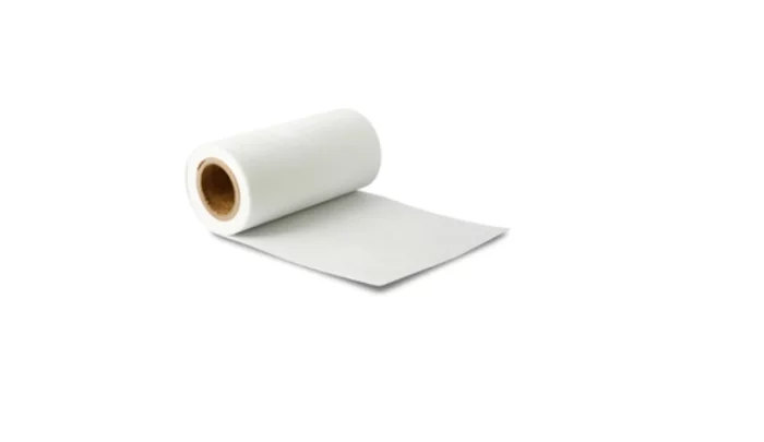
Hankuk Carbon
Glass Papers
GP division is producing Glass paper in the wet by glass fiber fabric as a main ingredient.
Glass Paper has a dimensional stability, heat resistance, chemical resistance, electrical insulation, Print Processability, heat insultion and so on. Due to its advanced quality, the Glass Paper is used by many manufacturers globally for floorings, buildings, exterior electronics.
Also, it is used for inorganic filter products, and diverse parts are under researching as its demands rise up.
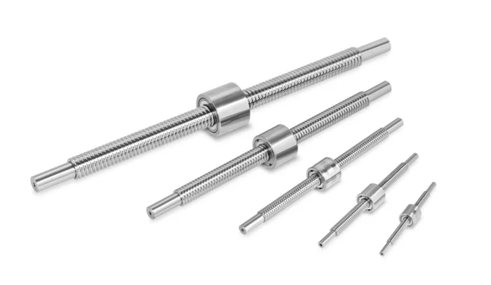
MPS bearings Co., Ltd.
Ball screws
MPS Microsystems offers a complete range of high precision ball screws for positioning less than 5 µm. Mostly custom-made, these screws ensure smooth and uniform movement resulting from the high precision of their thread, achieved by grinding.
Our ball screws are made exclusively of stainless steel and are fitted with double nuts to allow fine adjustment of the axial play. Moreover, an optional ogival thread can provide a higher static and dynamic load capacity.
Thanks to a large number of options, we can ensure that the ball screw meets your technical and quality needs. The following parameters can be personalized: lubricant (grease, oil, dry lubrication, no lubrication), customized screw ends, shape and external dimensions of the nut and screw, multiple nuts on the same screw, left-hand thread, thread length, specific axial play, special surface treatment, and more.

GE Aerospace
Military Systems
GE Aviation's Systems business is equipping militaries with the solutions needed to succeed. As a leading supplier of integrated systems and technologies for combat aircraft, military transport, helicopters, land vehicles and unmanned aerial vehicles (UAVs), GE is enabling armed forces around the world to improve reliability and enhance operational performance.