Seoul ADEX 2027 Digital Directory
Plan your trip to Seoul ADEX 2027 using our state of the art Digital Directory
Register in seconds with just your email


Directory Features
To help you at the show
In-depth Exhibitor Profiles
Each exhibitor can add as many products and services as they wish, with in-depth information and specifications. This allows buyers to find what they want easily.
Self Provisioning for Exhibitors
Each exhibitor has full control of their content - to edit their company profile, upload products and enter staff details.
Plan your trip
Use the bookmarking and event planning tool to research the companies you would like to visit and the products you are interested in finding. You will be able to locate all of your saved companies on our floorplan
Advanced Search
Utilize our advanced search function to quickly locate products, people, and companies. Our state-of-the-art technology thoroughly scans all exhibitor information, delivering precise and relevant results
Interactive Floorplan
Navigate the show effortlessly with our directory. Use the floorplan to locate companies you want to visit and to find your way to onsite restaurants, toilets and site entrances and exits.
On-platform Messaging
Reach out to exhibitors and visitors directly on our platform to set up meetings, or request more information.
Some of our latest content
Companies, Products, News, Events
Kallman Worldwide, Inc.
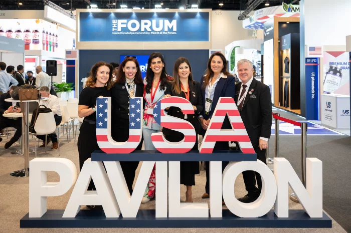
Pavilion Special Events
If it’s on our schedule, you’re invited. As an exhibitor in the Partnership Pavilion, in addition to official show events you also have exclusive access to official Pavilion events. Exhibitors benefit from exclusive access to the Partnership Pavilion events, including the official Pavilion Opening Ceremony and Ribbon-Cutting, off and on-site hospitality receptions, networking events, business and market insight briefings, and topical industry presentations.
Hessed Korea
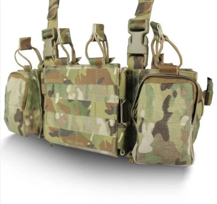
JTAC COMBAT ADJUSTABLE CHEST RACK DSCR006
Purposed for people carrying two or more radios (JTAC, LEADER, RTO, etc)
Removable shoulder & waist straps can be adjusted to fit the end-user without removing the rack
Attaching to select tactical plate carriers with the QASM buckle system or using stand-alone with H Harness
Small 4-way stretch Tweave general purpose pouch (Qty.1)
Magazine pouches for 5.56mm or 7.62mm mags (Qty. 2)
PRC-152A or 148 radio pouches (Qty. 2)
Removable antimicrobial/FR treated spacer mesh pad
Compatibility : PICO-DSX, PICO-DS, PICO-MBAV, EPIC-FED, EPIC-LOC-MOL & EPIC-DSX
Composition
Material : 500D Cordura® + ARAMID / PV®
Color :
MC (MultiCam)
BMC (Black MultiCam)
BK (Black)
RG (Ranger Green)
CYT (Coyote Brown)
Ansys_Korea
Digital Mission Engineering
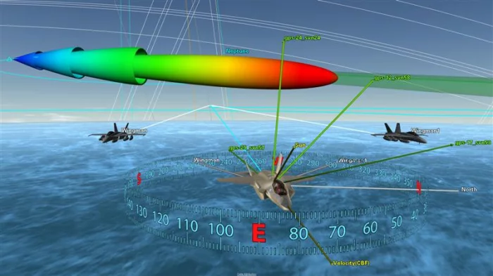
Digital mission engineering tools connect every stage of the engineering product lifecycle, from initial design to operation. They enable reality-based 3D simulation across multi-domain environments such as air, space, land, and sea by incorporating high-resolution terrain, satellite orbits, RF and radar systems, and sensor environments to accurately replicate real mission conditions.
With accurate dynamics-based physical models at the core, these tools provide quantitative analysis of relative positioning between systems, changes in altitude and attitude, line-of-sight availability, and communication link status. Users can predict and evaluate mission elements such as sensor operations, communication links, platform maneuvers, and orbit optimization through scenario-based simulations.
Hessed Korea
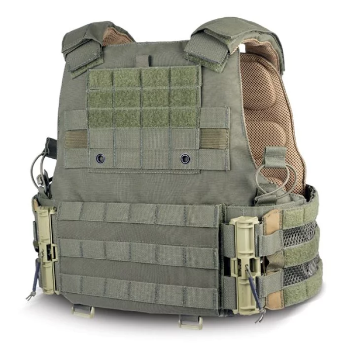
PICO-MVW-DSX ASSAULTER’S PLATE CARRIER
Taktic buckle system for quick connect & release
Antibacterial/FR treated padded spacer mesh system
Poly mesh cummerbund for increased ventilation
XFrame® Dynamic Load Carrige® compatible
Compatible with our entire accessories line
Flush admin chest pocket with internal elastic straps
PALS webbing for MOLLE attachment
Zipper for DS Assaulter's Zip-On Back Panels
QASM buckle system
Increased structural integrity and reduced rear deformation
Internal plate pocket retention straps accommodate several different plate thickness
Soft armor included
Composition
Material: 500D Cordura® + ARAMID/PV®
Size :
Small / Medium : 8.5" x 11.5” -9.3" x 12.3" Plate Pocket
Front Panel Area of Coverage : Length 13.25” Width 11"
Large / XLarge : 10" x 13"- 10.9" x 13.8” Plate Pocket
Front Panel Area of Coverage : Length 15" Width 12"
Colors:
MC (MultiCam)
BMC (Black MultiCam)
BK (Black)
RG (Ranger Green)
CYT (Coyote Brown)