한국어로 페이지 보기
Seoul ADEX 2025 Digital Directory
Plan your trip to Seoul ADEX 2025 using our state of the art Digital Directory
Register in seconds with just your email


Directory Features
To help you at the show
In-depth Exhibitor Profiles
Each exhibitor can add as many products and services as they wish, with in-depth information and specifications. This allows buyers to find what they want easily.
Self Provisioning for Exhibitors
Each exhibitor has full control of their content - to edit their company profile, upload products and enter staff details.
Plan your trip
Use the bookmarking and event planning tool to research the companies you would like to visit and the products you are interested in finding. You will be able to locate all of your saved companies on our floorplan
Advanced Search
Utilize our advanced search function to quickly locate products, people, and companies. Our state-of-the-art technology thoroughly scans all exhibitor information, delivering precise and relevant results
Interactive Floorplan
Navigate the show effortlessly with our directory. Use the floorplan to locate companies you want to visit and to find your way to onsite restaurants, toilets and site entrances and exits.
On-platform Messaging
Reach out to exhibitors and visitors directly on our platform to set up meetings, or request more information.
Some of our latest content
Companies, Products, News, Events
_700.webp)
LUMIR
On-Board Computer, OBC
Lumir developed this new on-board computer in cooperation with Korea Aerospace Industries (KAI) for the CAS500-3 (technology verification satellite), which is scheduled to be launched aboard Korea’s fourth Nuri launch vehicle.

L3Harris Technologies, Inc.
YouTube
In an uncertain world, L3Harris is anticipating and rapidly responding to challenges with agile technology - creating a safer and more secure future.

GE Aerospace
GE's T901 engine is ready for the future of the US Army rotorcraft aviation
GE's T901 Engine for ITEPA test cell is not a combat mission. In combat, there is no time for an unproven design. With more than 100 million flight hours of ...
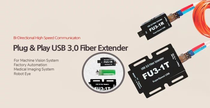
Syscom Korea Co., Ltd.
Plug-and-Play USB3.0 Fiber Optic Extender (Fiber Repeater) , FU3-1T/R
Machine vision system
Factory automation
Medical imaging systems
Robot eyes

View page in English


디렉터리 기능
전시회 도우미
In-depth Exhibitor Profiles
Each exhibitor can add as many products and services as they wish, with in-depth information and specifications. This allows buyers to find what they want easily.
Self Provisioning for Exhibitors
Each exhibitor has full control of their content - to edit their company profile, upload products and enter staff details.
방문 계획 수립
북마크 도구와 이벤트 플래너를 사용해 방문하고자 하는 기업과 관심 있는 제품을 검색하세요. 저장한 모든 항목을 조회할 수 있습니다
고급 검색
고급 검색 기능을 사용하여 상품, 인물, 기업의 위치를 빠르게 조회할 수 있습니다. 최첨단 기술을 통해 모든 참가사의 정보를 철저히 스캔하여 세밀하고 관련성 있는 정보를 제공합니다
상호작용 가능 평면도
디렉터리를 사용해 전시회를 손쉽게 둘러보세요. 방문하고자 하는 기업의 위치와, 행사장 내 식당, 화장실, 출입구를 평면도에서 찾을 수 있습니다.
플랫폼 내 메시지
플랫폼 상의 전시 참가사와 관람객에게 직접 연락하여 미팅을 신청하거나 추가 정보를 요청하세요.
최신 콘텐츠
기업, 상품, 뉴스, 이벤트
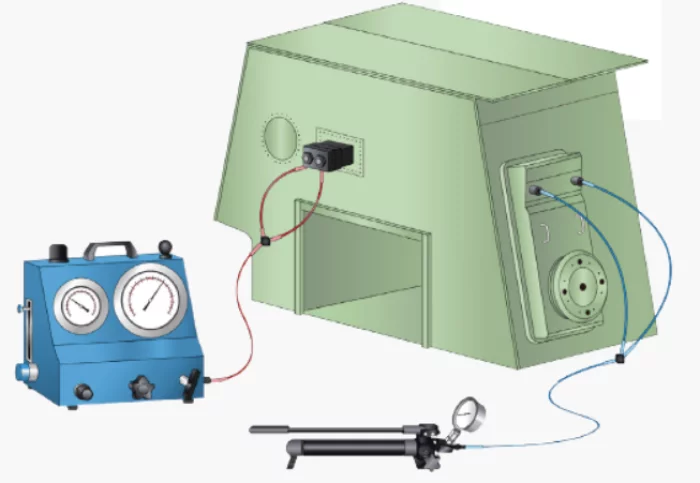
HANMI HYDRAULIC MACHINERY CO., LTD.
Main engine hydraulic tools package(Pump, Jack, Hose, Coupler)
This hydraulic tool package product is an ultra-high-pressure tool product used to assemble and disassemble major parts that make up the engine, and has been supplied to domestic and overseas engine customers since our foundation. The composition consists of a hydraulic pump, a hydraulic jack, a hydraulic hose, and a coupler, and supplies one package per ship. The product model can be selected according to the required pressure for each engine type and model.
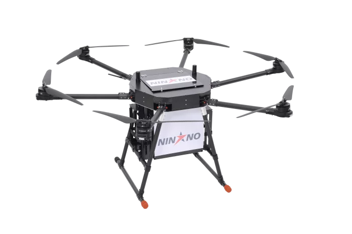
NINANO COMPANY INC.
PELICAN
It can carry and deliver payloads of 5 to 10 kilograms, making it suitable for commercial and industrial logistics. The drone has been successfully tested in extreme environments, ensuring stable performance under harsh conditions. With its proven capability, PELICAN expands the possibilities of drone-based delivery solutions in both urban and remote areas.
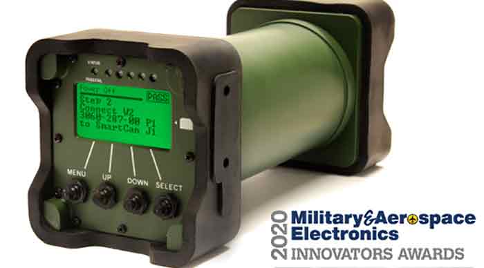
Marvin Test Solutions
MTS-3060A SmartCan™ Overview
MTS-3060A SmartCan is a
Universal O-Level Armament Test Set
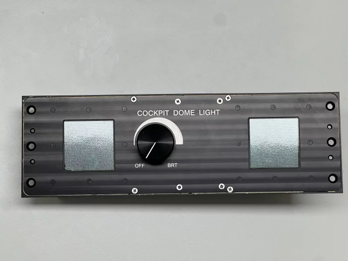
DIGITRON. Co., Ltd.
GENERAL COCKPIT LIGHT
- Interior light that illuminates the entire cockpit
- Adjust the DIM/BRT brightness by operating the knob switch
- NVIS WHITE per MIL-STD-3009