
 Digital Directory
한국어로 페이지 보기
Seoul ADEX 2025 Digital Directory
Plan your trip to Seoul ADEX 2025 using our state of the art Digital Directory
Register in seconds with just your email


Directory Features
To help you at the show
In-depth Exhibitor Profiles
Each exhibitor can add as many products and services as they wish, with in-depth information and specifications. This allows buyers to find what they want easily.
Self Provisioning for Exhibitors
Each exhibitor has full control of their content - to edit their company profile, upload products and enter staff details.
Plan your trip
Use the bookmarking and event planning tool to research the companies you would like to visit and the products you are interested in finding. You will be able to locate all of your saved companies on our floorplan
Advanced Search
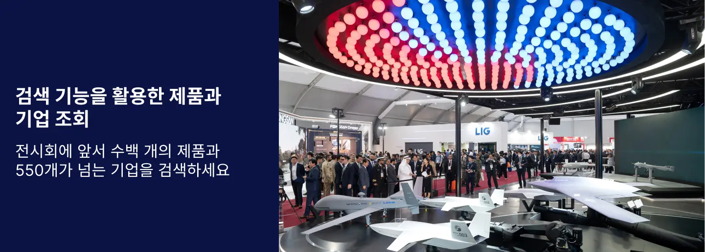
Utilize our advanced search function to quickly locate products, people, and companies. Our state-of-the-art technology thoroughly scans all exhibitor information, delivering precise and relevant results
Interactive Floorplan
Navigate the show effortlessly with our directory. Use the floorplan to locate companies you want to visit and to find your way to onsite restaurants, toilets and site entrances and exits.
On-platform Messaging
Reach out to exhibitors and visitors directly on our platform to set up meetings, or request more information.
Some of our latest content
Companies, Products, News, Events
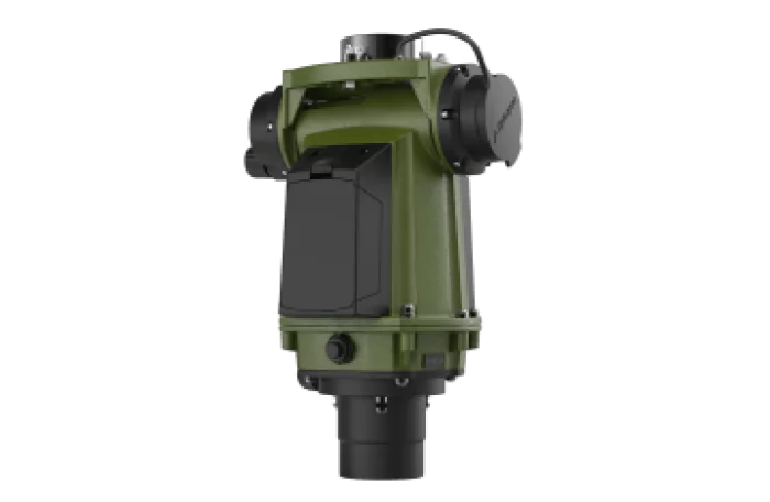
SAFRAN
STERNA
STERNA System accurately finds True North in virtually all terrains and regardless of the weather conditions. The performance of STERNA System is not disturbed by gear carried by its operator or if used next to heavy armored vehicles. It remains highly accurate even when deployed on reinforced concrete floors or in dense urban settings. STERNA System operates reliably even in GPS denied environments and does not require the operator to carry any support resources to determine True North. If your mission success depends on the highest level of accuracy and precision, there is no substitute for STERNA System.
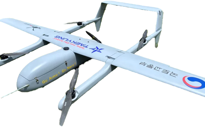
TAEKYUNG ELEC. Co., LTD.
e-VTOL-350
Our e-VTOL drone offers versatile vertical take-off and landing capabilities with precise and stable flight. Equipped with advanced sensors and real-time camera monitoring, it ensures safe and efficient operations in diverse environments.
 SpaceEye-M_700.webp)
Satrec Initiative
SpaceEye-M
0.8m급 고해상도 초소형 지구관측 위성으로,
군집운용을 통해 고빈도 · 정밀 감시체계를 구축합니다.
SpaceEye-M is a small satellite to produce high-resolution image data.
A constellation of SpaceEye-M can perform precise monitoring over a large area with high revisit.
K-PA Inc.
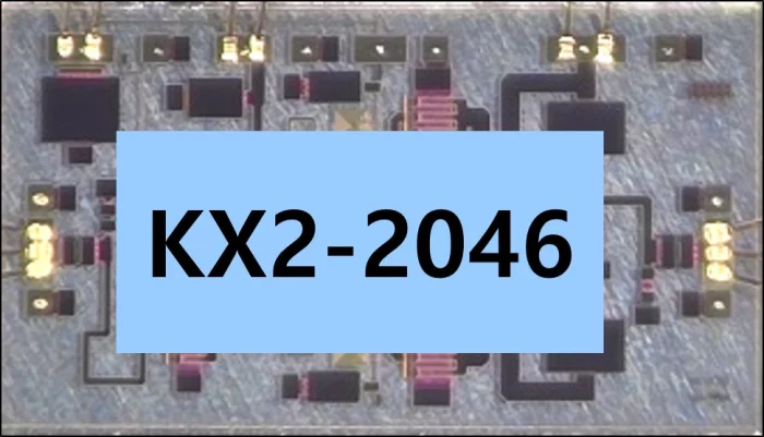
KX2-2046
The KX2-2046 is an X-band high-power MMIC amplifier fabricated on the GaN-on-SiC process. It operates from 8.0 – 10.5 GHz and typically provides 20W saturated output power with power-added efficiency of 46%.
The KX2-2046 can support military and commercial radar systems. It is matched to 50Ω with integrated DC blocking capacitors on both RF input and output ports.
The KX2-2046 is 100% DC and RF tested on-wafer. It is available in chip form.
**Key Features**
- Frequency Range: 8.0-11.5GHz
- Small Signal Gain: 26dB
- High Pout: 20W
- High PAE: 46%
- DC bias: Vd=28V @Idq=0.3A
- Pulsed Vg: PW=100µs, DC=10%
- Chip size: 2.95x1.66x0.1mm
View page in English

디렉터리 기능
전시회 도우미
In-depth Exhibitor Profiles
Each exhibitor can add as many products and services as they wish, with in-depth information and specifications. This allows buyers to find what they want easily.
Self Provisioning for Exhibitors
Each exhibitor has full control of their content - to edit their company profile, upload products and enter staff details.
방문 계획 수립
북마크 도구와 이벤트 플래너를 사용해 방문하고자 하는 기업과 관심 있는 제품을 검색하세요. 저장한 모든 항목을 조회할 수 있습니다
고급 검색
고급 검색 기능을 사용하여 상품, 인물, 기업의 위치를 빠르게 조회할 수 있습니다. 최첨단 기술을 통해 모든 참가사의 정보를 철저히 스캔하여 세밀하고 관련성 있는 정보를 제공합니다
상호작용 가능 평면도
디렉터리를 사용해 전시회를 손쉽게 둘러보세요. 방문하고자 하는 기업의 위치와, 행사장 내 식당, 화장실, 출입구를 평면도에서 찾을 수 있습니다.
플랫폼 내 메시지
플랫폼 상의 전시 참가사와 관람객에게 직접 연락하여 미팅을 신청하거나 추가 정보를 요청하세요.
최신 콘텐츠
기업, 상품, 뉴스, 이벤트
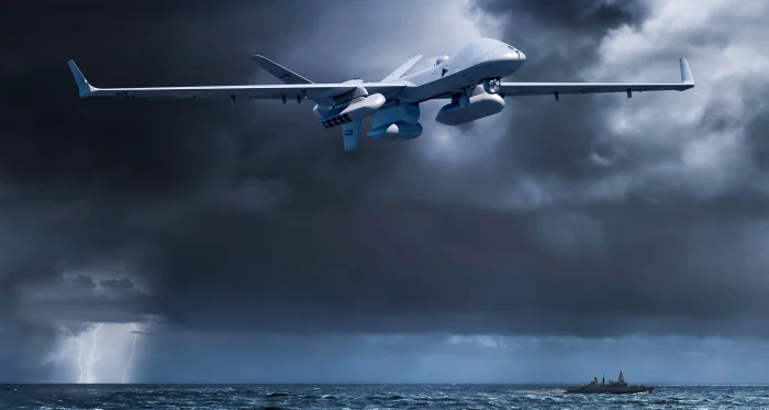
General Atomics Aeronautical Systems, Inc.
MQ-9B SeaGuardian
MQ-9B SeaGuardian® is the maritime-focused sibling of the
revolutionary SkyGuardian® remotely piloted aircraft system
(RPAS) that has been missionized using “bolt-on/bolt-off” maritime
sensors. SeaGuardian is designed to fly over the horizon via
satellite for over 30 hours (depending on configuration) in all
types of weather and safely integrate into civil airspace, enabling
joint forces and civil authorities to deliver real-time situational
awareness anywhere in the maritime domain—day or night. This
highly versatile maritime patrol and reconnaissance aircraft can
seamlessly integrate a centerline wide-area maritime radar, an
automatic identification system (AIS), electronic support measures,
and a self-contained anti-submarine warfare (ASW) mission kit.
SeaGuardian not only integrates the most advanced maritime
intelligence, surveillance, and reconnaissance (ISR) capabilities,
but it is also the first RPAS in its class to enable real-time search
and patrol above and below the ocean’s surface.
revolutionary SkyGuardian® remotely piloted aircraft system
(RPAS) that has been missionized using “bolt-on/bolt-off” maritime
sensors. SeaGuardian is designed to fly over the horizon via
satellite for over 30 hours (depending on configuration) in all
types of weather and safely integrate into civil airspace, enabling
joint forces and civil authorities to deliver real-time situational
awareness anywhere in the maritime domain—day or night. This
highly versatile maritime patrol and reconnaissance aircraft can
seamlessly integrate a centerline wide-area maritime radar, an
automatic identification system (AIS), electronic support measures,
and a self-contained anti-submarine warfare (ASW) mission kit.
SeaGuardian not only integrates the most advanced maritime
intelligence, surveillance, and reconnaissance (ISR) capabilities,
but it is also the first RPAS in its class to enable real-time search
and patrol above and below the ocean’s surface.
_700.webp)
Mutronics, Inc.
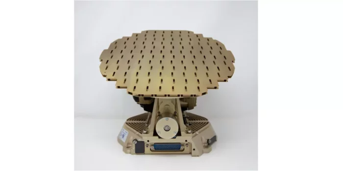
Multi-Function Radar Antenna, Radome
Phased Array Multi Function Antenna including Radome
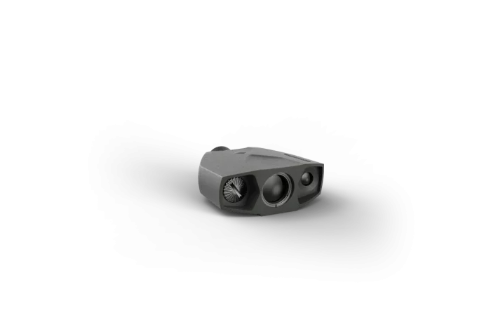
SAFRAN
TERRAPIN X
TERRAPIN X is a rugged handheld laser rangefinder by Safran Vectronix, offering up to 3,000 m range with 8× magnification, Class 1 eye-safe laser (905 nm), and a 28 mm objective lens. It features precise beam divergence (1.2 × 0.5 mrad), slope and azimuth compensation, scan mode (≥2 readings/sec), and durable Ryton® housing with shock-resistant rubber armor (IP67). Advanced Bluetooth connectivity integrates with mobile apps and devices such as Kestrel LiNK, Garmin, Strelok Pro, and includes a dedicated smartphone app.
Honeywell Aerospace Technologies
IntuVue RDR-7000 Weather Radar System
The IntuVue RDR-7000 is fully automatic and does'nt require active pilot adjustments of tilt and/or gain for operation. Reducing workload, allows pilots to focus on flying the most comfortable and safest route through weather.
Engineered to provide far superior reliability, accuracy and durability than legacy magnetron-based radar systems, the RDR-7000 offers customers the flexibility to remotely enable advanced software features to provide them the clearest view of weather conditions around the routes they’re accustomed to flying.
Key Honeywell Advantages:
Next generation -fully automated, higher resolution weather radar system with airborne ground/sea mapping system
Reliable and efficient - solid-state transmitters utilizing pulse compression provide reduced weight and power consumption, advanced coherent processing, and increased reliability
Compact and easy to install - RDR-7000 IntuVue radar systems technology integrated into a small, lightweight package
Available software upgrades - advanced features can be added at any time, including turbulence detection, advanced mapping, target detection and additional hazard features (lightning and hail detection), and forward looking (predictive) windshear
Honeywell's RDR 7000 Radar helps in operational costs savings by reducing the delays & downtime caused due to hailstorm, weather incidents and windshears while optimizing routes to reduce diversions and turnbacks.