
 Digital Directory
한국어로 페이지 보기
Seoul ADEX 2025 Digital Directory
Plan your trip to Seoul ADEX 2025 using our state of the art Digital Directory
Register in seconds with just your email


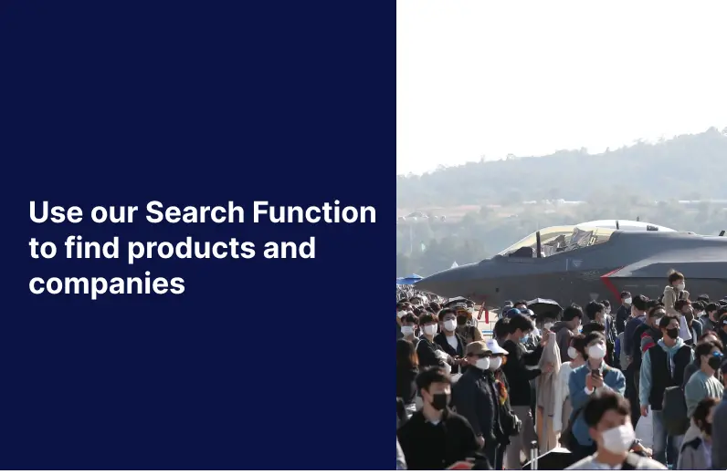

Directory Features
To help you at the show
In-depth Exhibitor Profiles
Each exhibitor can add as many products and services as they wish, with in-depth information and specifications. This allows buyers to find what they want easily.
Self Provisioning for Exhibitors
Each exhibitor has full control of their content - to edit their company profile, upload products and enter staff details.
Plan your trip
Use the bookmarking and event planning tool to research the companies you would like to visit and the products you are interested in finding. You will be able to locate all of your saved companies on our floorplan
Advanced Search
Utilize our advanced search function to quickly locate products, people, and companies. Our state-of-the-art technology thoroughly scans all exhibitor information, delivering precise and relevant results
Interactive Floorplan
Navigate the show effortlessly with our directory. Use the floorplan to locate companies you want to visit and to find your way to onsite restaurants, toilets and site entrances and exits.
On-platform Messaging
Reach out to exhibitors and visitors directly on our platform to set up meetings, or request more information.
Some of our latest content
Companies, Products, News, Events
BAE Systems
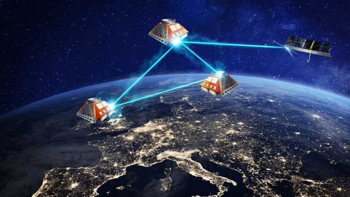
Azalea™: Low Earth Orbit satellite system
Azalea™ is our programme to launch a multi-sensor, multi-role satellite system with powerful Radio Frequency (RF) capabilities into low Earth orbit. The system will gather a wide range of data and analyse it in-orbit, using on-board machine learning to deliver intelligence wherever it’s needed.
The technology provided by Azalea will enable us to deliver advanced Intelligence, Surveillance and Reconnaissance (ISR) capabilities – boosting the UK’s ability to understand threats and hazards in, from and through space.
We are collaborating with and investing in the space ecosystem to develop Azalea, supplementing our in-house capability to create, launch and operate end-to-end space missions.
OLZETEK Inc.
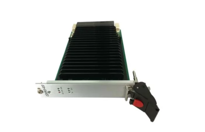
Video Display Card
OZVPX3-410 is Olzetek's flagship 3U product. Olzetek's 3U Platform Family has maximum scalability using Xilinx Zynq® UltraScale +MPSoC, which is capable of a high-performance Arm®-based multi-core and multi-processing system, as well as video signal/packet processing functions, graphics and video pipelines. This is a SoC product designed to meet challenging demands by offloading essential applications to dedicated processing blocks and supporting major peripherals and interfaces. The OZVPX3-410 product is an ideal solution that can be applied to applications requiring Analog Video (PAL/NTSC) encoding and decoding and includes customization options (consignment development) according to specific video inputs, requirements analysis, and design. We also provide consignment development of a complete Video 3U Platform.
Ace Technologies Corp.
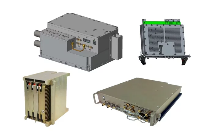
Datalink Antenna System
국내 최초로 GaN MMIC HPA 개발을 통한 레이다 탐지용 TR Module 개발로 핵심기술을 확보 하였으며 S ~ Ka대역 주파수 범위에 최적화된 다양한 제품을 개발, 생산하고 있습니다.
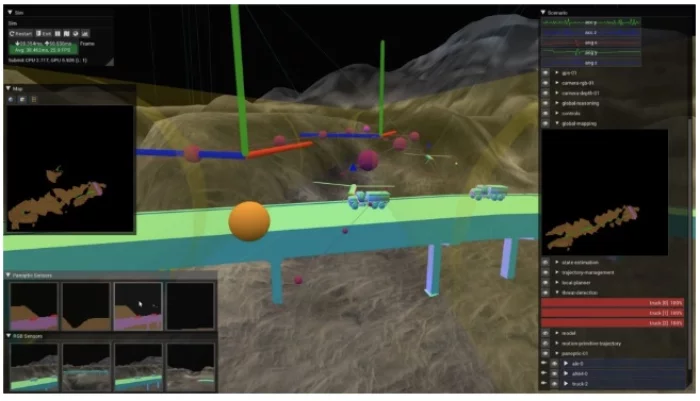
Shield AI
Hivemind - Autonomous AI Pilot
The First & Only Autonomous AI Pilot Deployed Since 2018
Similar to a human pilot, Hivemind reads and reacts to the battlefield, and does not require GPS, waypoints, or comms to make decisions. Hivemind enables intelligent teams to perform missions ranging from room clearance with Novas, penetrating air defense systems with V-BATs, to dogfighting F-16s.
Intelligent Teaming
Shield AI’s synthetic environments combined with human-machine tactics and behaviors. Testing and learning in real physics simulations reduces engineering cycle times and enables rapid real-world deployment. Welcome to the defense metaverse.
Edge Autonomy
The aircraft uses sensors to create a map or world-view, the computer then tells the aircraft or autopilot where to go and what to do to execute its mission. No GPS, no waypoints, and no comms are needed for aircraft to accomplish their missions.
Similar to a human pilot, Hivemind reads and reacts to the battlefield, and does not require GPS, waypoints, or comms to make decisions. Hivemind enables intelligent teams to perform missions ranging from room clearance with Novas, penetrating air defense systems with V-BATs, to dogfighting F-16s.
Intelligent Teaming
Shield AI’s synthetic environments combined with human-machine tactics and behaviors. Testing and learning in real physics simulations reduces engineering cycle times and enables rapid real-world deployment. Welcome to the defense metaverse.
Edge Autonomy
The aircraft uses sensors to create a map or world-view, the computer then tells the aircraft or autopilot where to go and what to do to execute its mission. No GPS, no waypoints, and no comms are needed for aircraft to accomplish their missions.
View page in English

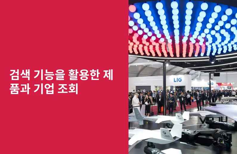
디렉터리 기능
전시회 도우미
In-depth Exhibitor Profiles
Each exhibitor can add as many products and services as they wish, with in-depth information and specifications. This allows buyers to find what they want easily.
Self Provisioning for Exhibitors
Each exhibitor has full control of their content - to edit their company profile, upload products and enter staff details.
방문 계획 수립
북마크 도구와 이벤트 플래너를 사용해 방문하고자 하는 기업과 관심 있는 제품을 검색하세요. 저장한 모든 항목을 조회할 수 있습니다
고급 검색
고급 검색 기능을 사용하여 상품, 인물, 기업의 위치를 빠르게 조회할 수 있습니다. 최첨단 기술을 통해 모든 참가사의 정보를 철저히 스캔하여 세밀하고 관련성 있는 정보를 제공합니다
상호작용 가능 평면도
디렉터리를 사용해 전시회를 손쉽게 둘러보세요. 방문하고자 하는 기업의 위치와, 행사장 내 식당, 화장실, 출입구를 평면도에서 찾을 수 있습니다.
플랫폼 내 메시지
플랫폼 상의 전시 참가사와 관람객에게 직접 연락하여 미팅을 신청하거나 추가 정보를 요청하세요.
최신 콘텐츠
기업, 상품, 뉴스, 이벤트
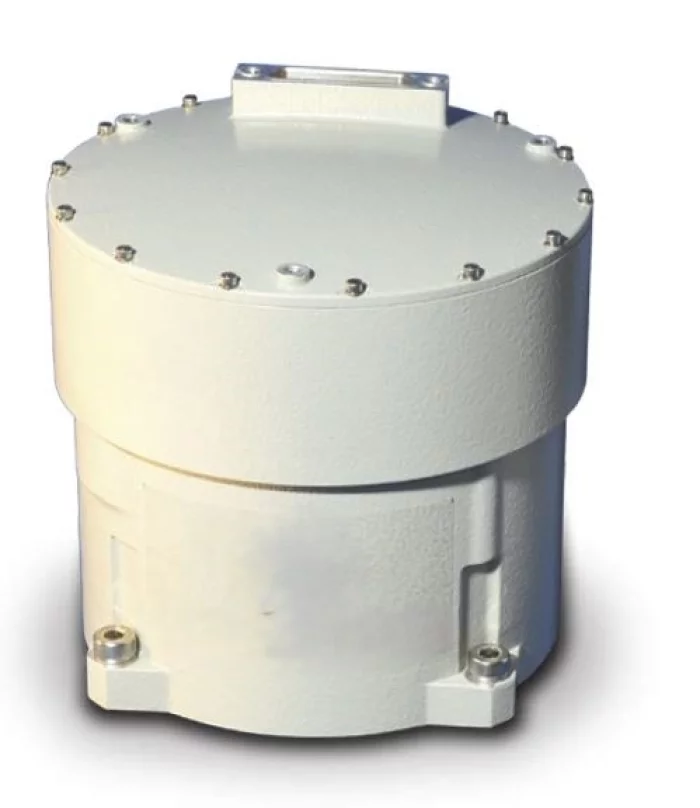
EMCORE
SUPER TAC IMU - Super-Tactical (TAC) Inertial Measurement Unit (IMU
The new Super-TAC IMU integrates three fiber optic gyros that exceed tactical grade performance with three high-accuracy Micro-Electro-Mechanical Systems (MEMS) accelerometers and state-of-the-art support electronics in a single small, lightweight package. This solution addresses the need for superior inertial performance in a tactical- grade package, critical for operation in GPS denied and contested environments.
The Super-TAC IMU measures change in velocity and angle, utilizing a configurable variable synchronous data link control (SDLC) digital serial bus. The Super-TAC is configured to offer customers the best value solution when designing new systems as well as provide the flexibility to upgrade existing platforms.
The Super-TAC IMU employs state-of-the-art optics with fewer components, providing significant performance and reliability improvements across standard military environments.
Background
Emcore, located in Budd Lake, NJ has been designing, developing and producing inertial components, sensors and navigation systems for Space, Ground, and Avionic applications for over 35 years. Emcore has been developing Fiber Optic Gyros (FOGs) since the early 1990s, producing and delivering IMU products with performance ranging from tactical to strategic grade
PERFORMANCE
GYRO PERFORMANCE
Bias Stability < 0.05 °/hr. (1σ)
Angle Random Walk ( ARW) ≤ 0.01 °/√hr. (1σ)
Scale Factor Repeatability ≤ 100 ppm (1σ)
Scale Factor Linearity ≤ 50 ppm (1σ)
Angular Rate Range 1,000 °/sec
Acceleration Range 100,000 °/sec2
ACCELEROMETER PERFORMANCE
Range ± 25 g
Bias Variation ≤ 50 μg (1σ)
Scale Factor Stability ≤ 300 ppm (1σ)
SYSTEM PERFORMANCE
Bandwidth (adjustable) 800 Hz (gyros)
150 Hz (accelerometers)
MTBF >25,000 hr.
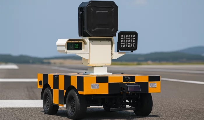
SkyAutoNet
Autonomous Bird-Repelling Robot
# Key Features
- Map Generation and No-Drive Zone Setting in Airports
> Airport map/sensor fusion-based localization function
> Function for defining main movement and standby areas
> No-drive zone setting
- Optimal Path Autonomous Driving Function
> Destination-based optimal path navigation
> Speed limit settings by path and area
> Real-time location monitoring
> Obstacle detection and immediate response
> Driving on diverse road surfaces within designated areas
- Real-Time Bird Detection and Bird Position/Direction Prediction
> Real-time bird detection
> Support for approximate bird position/direction prediction based on object detection algorithms
> Updating of approximate bird position/direction prediction based on flock detection
- Effective Bird Deterrence Reflecting Bird Characteristics
> Playback of diverse (randomized) acoustic patterns
- Real-Time Communication with Operator and Manual Control Function
> Monitoring console (PC) provides real-time bird detection status and history
> Display of approximate bird position/direction predictions on a map
> Real-time video data sharing
> Remote manual control
- Smart Charging Function
> Automatic return and charging when mission is complete or battery is low
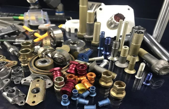
A-Tech Aviation
Hardware
Hardware
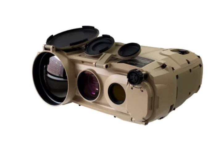
EO System
Multi-Function Observation Device
THETIS-M2 is a multifunction thermal imaging system that provides soldiers with an advanced, light weight solution for day and night reconnaissance, surveillance and forward observation purposes.
It also gives the blue forces a real-time target acquisition and target coordinate calculation capabilities.
Thermal Camera + Direct View Optic +Laser Range Finder + Digital Magnetic Compass + GPS