한국어로 페이지 보기
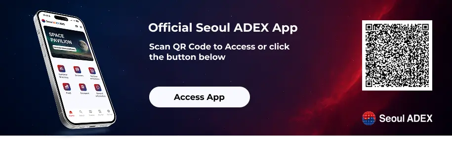
Seoul ADEX 2025 Digital Directory
Plan your trip to Seoul ADEX 2025 using our state of the art Digital Directory
Register in seconds with just your email


Directory Features
To help you at the show
In-depth Exhibitor Profiles
Each exhibitor can add as many products and services as they wish, with in-depth information and specifications. This allows buyers to find what they want easily.
Self Provisioning for Exhibitors
Each exhibitor has full control of their content - to edit their company profile, upload products and enter staff details.
Plan your trip
Use the bookmarking and event planning tool to research the companies you would like to visit and the products you are interested in finding. You will be able to locate all of your saved companies on our floorplan
Advanced Search
Utilize our advanced search function to quickly locate products, people, and companies. Our state-of-the-art technology thoroughly scans all exhibitor information, delivering precise and relevant results
Interactive Floorplan
Navigate the show effortlessly with our directory. Use the floorplan to locate companies you want to visit and to find your way to onsite restaurants, toilets and site entrances and exits.
On-platform Messaging
Reach out to exhibitors and visitors directly on our platform to set up meetings, or request more information.
Some of our latest content
Companies, Products, News, Events
Integrated Procurement Technologies
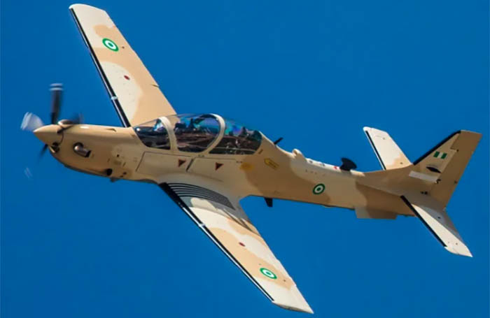
A-29
A-29 SUPER TUCANO
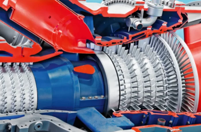
BIBUS METALS KOREA
Power Generation
INCONEL® Alloy 230
Bars-Sheets and Plates
INCONEL® Alloy 600
Bars-Sheets and Plates-Wire-Tubes and Pipes
INCONEL® Alloy 601
Bars-Sheets and Plates-Wire-Tubes and Pipes
INCONEL® Alloy 617
Bars-Sheets and Plates
INCONEL® Alloy 625
Bars-Sheets and Plates-Tubes and Pipes
INCONEL® Alloy 718
Bars-Sheets and Plates
INCONEL® Alloy X-750
Bars-Sheets and Plates
INCONEL® Alloy HX
Bars-Sheets and Plates-Tubes and Pipes
NIMONIC® Alloy 75
Bars-Sheets and Plates
NIMONIC® Alloy 80A
Bars-Sheets and Plates
NIMONIC® Alloy 90
Bars-Sheets and Plates-Wire-Strip
NIMONIC® Alloy 263
Sheets and Plates
UDIMET® Alloy 188
Bars-Sheets and Plate
UDIMET® Alloy L-605
Bars-Sheets and Plates
Waspaloy®
Sheets and Plates
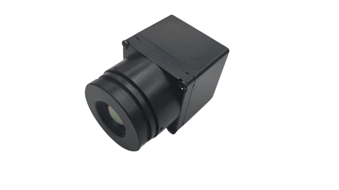
CanLab
Thermal Camera (VGA)
A VGA (640×480) LWIR (8–12 µm) uncooled micro-bolometer module with 12 µm pixel pitch and NETD ≤ 50 mK, paired with an F1.0, 10.7 mm EFL lens delivering H42° / V31.5° / D52.5° FOV. It streams at 30 Hz in either UVC (USB-C, 5 V) or GMSL1 (FAKRA, 12 V), with power consumption < 1.9 W. The compact, lightweight housing (30×30×58.9 mm for UVC; 30×30×70.9 mm with FAKRA for GMSL1; IP65; −40 °C to 85 °C) makes it well-suited for autonomous vehicles, UAVs, and security systems, providing reliable day/night thermal perception of pedestrians, animals, and objects in adverse weather.
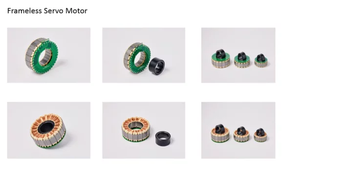
KOMOTEK CO., LTD.
Frameless servo motor
Various line up, high torque frameless motor capable of precise speed and position control. Application areas are Collaborative robots, Dog Horse robots.

View page in English


디렉터리 기능
전시회 도우미
In-depth Exhibitor Profiles
Each exhibitor can add as many products and services as they wish, with in-depth information and specifications. This allows buyers to find what they want easily.
Self Provisioning for Exhibitors
Each exhibitor has full control of their content - to edit their company profile, upload products and enter staff details.
방문 계획 수립
북마크 도구와 이벤트 플래너를 사용해 방문하고자 하는 기업과 관심 있는 제품을 검색하세요. 저장한 모든 항목을 조회할 수 있습니다
고급 검색
고급 검색 기능을 사용하여 상품, 인물, 기업의 위치를 빠르게 조회할 수 있습니다. 최첨단 기술을 통해 모든 참가사의 정보를 철저히 스캔하여 세밀하고 관련성 있는 정보를 제공합니다
상호작용 가능 평면도
디렉터리를 사용해 전시회를 손쉽게 둘러보세요. 방문하고자 하는 기업의 위치와, 행사장 내 식당, 화장실, 출입구를 평면도에서 찾을 수 있습니다.
플랫폼 내 메시지
플랫폼 상의 전시 참가사와 관람객에게 직접 연락하여 미팅을 신청하거나 추가 정보를 요청하세요.
최신 콘텐츠
기업, 상품, 뉴스, 이벤트
_700.webp)
Bombardier Defense
Bombardier Global 8000 aircraft
The Bombardier Global 8000 aircraft, set to enter into service in the second half of 2025, is the fastest and farthest flying business jet in the industry. The Global 8000 aircraft can be outfitted with secure communications, navigation and self-protection systems.
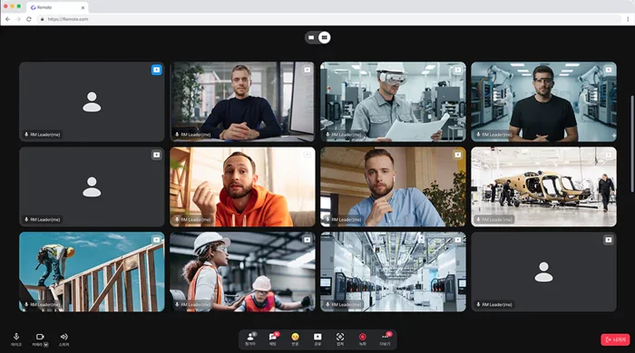
VIRNECT
VIRNECT Remote: Real-Time Remote Collaboration Solution
Live Video Sharing: Stream real-time video to remote experts for instant troubleshooting.
AR Annotation: Remote experts can overlay AR markers and annotations directly onto the worker's view.
Multi-User Collaboration: Multiple participants can join for a seamless remote teamwork experience.
Multi-Device Compatibility: Available on PCs, tablets, smartphones, and smart glasses (VisionX) for maximum flexibility.
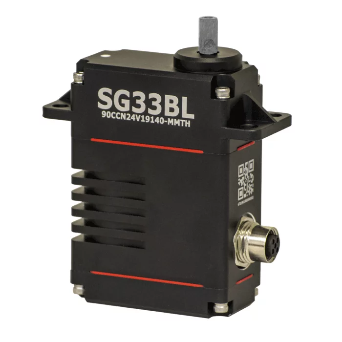
hitecrcd Korea
SG33BLT-CAN-12V-CIRCULAR-CONN
The mighty Hitec SG33BLT Series servo actuators operate on DroneCAN (formerly UAVCAN), CAN 2.0 A/B, RS485, PWM and TTL command protocols, and feature brushless motors, magnetic encoders, and hardened steel gears. They are also environmentally sealed with an IP67 waterproof case rating. The SG33BLT Series was initially developed for the automotive industry requiring minimal support equipment and wiring, saving unnecessary installation complexity, cost and weight. This same functionality is now enjoying widespread adoption of CAN and DroneCAN systems within the UAV environment. With options for both 9~15-volt and 18~32-volt operations, and DB9SUB, Circular, & Gland Cable connectivity, the SG33BLT Actuator Series is sure to have a solution for your needs.
#UAV #UAS #UAM #UGV #UUV #USV
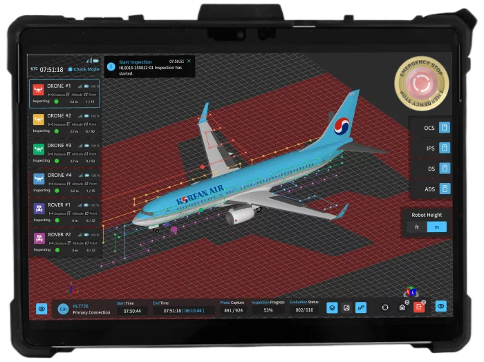
SOLETOP
Mobile Contoller SW
- Inspection robot control and damage assessment for robot operators.
- Pre-inspection information creation for inspection planning.
- A 3D user interface for inspection robot status monitoring.
- Damage assessment and result report generation capabilities.