한국어로 페이지 보기
Seoul ADEX 2025 Digital Directory
Plan your trip to Seoul ADEX 2025 using our state of the art Digital Directory
Register in seconds with just your email


Directory Features
To help you at the show
In-depth Exhibitor Profiles
Each exhibitor can add as many products and services as they wish, with in-depth information and specifications. This allows buyers to find what they want easily.
Self Provisioning for Exhibitors
Each exhibitor has full control of their content - to edit their company profile, upload products and enter staff details.
Plan your trip
Use the bookmarking and event planning tool to research the companies you would like to visit and the products you are interested in finding. You will be able to locate all of your saved companies on our floorplan
Advanced Search
Utilize our advanced search function to quickly locate products, people, and companies. Our state-of-the-art technology thoroughly scans all exhibitor information, delivering precise and relevant results
Interactive Floorplan
Navigate the show effortlessly with our directory. Use the floorplan to locate companies you want to visit and to find your way to onsite restaurants, toilets and site entrances and exits.
On-platform Messaging
Reach out to exhibitors and visitors directly on our platform to set up meetings, or request more information.
Some of our latest content
Companies, Products, News, Events
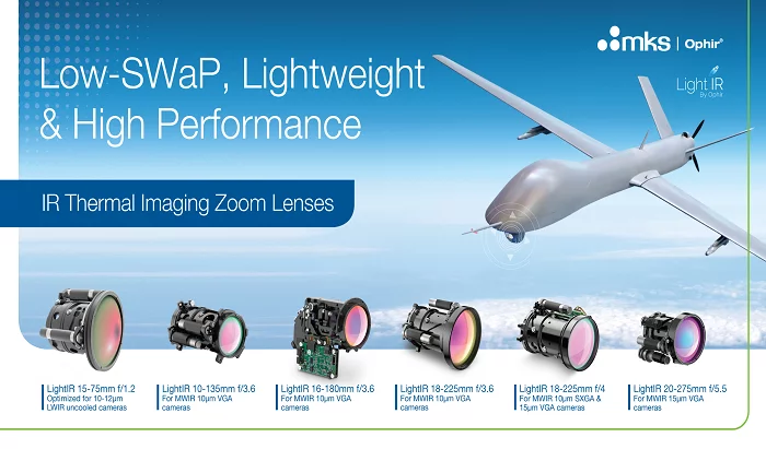
MKS Ophir
LightIR, Low-SWaP IR Cont. Zoom Lens Collection for Airborne and HHTI EO Systems
LightIR series key features:
• High MTF performance
• Extremely compact, light, configurations
• Suitable for a wide range of low-SWaP applications
• Maintains focus through the entire zoom range
• Compatible with major MWIR and LWIR detectors
• Designed to withstand harsh environmental conditions
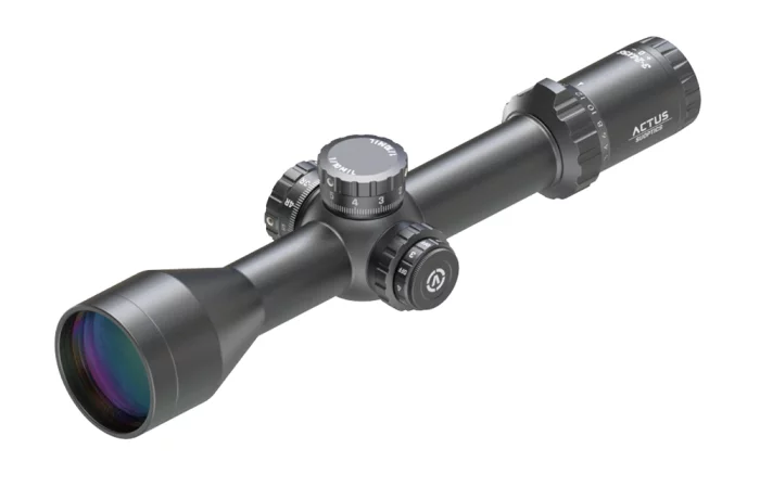
SU Optics
ACTUS® ARKS3245 Long Range Riflescope
The ACTUS® ARKS3245 (3-24X, 56mm FFP) Long Range Riflescope is expertly designed for precision and durability, meeting the demanding needs of professional users across a wide range of environments.
With a First Focal Plane (FFP) optical design, it ensures fast and accurate target coverage at all magnification levels. The illuminated reticle provides clear and smooth targeting even in low-light conditions, such as at dawn or dusk.
Whether you're operating in challenging or ever-changing environments, the ACTUS® ARKS3245 is the ideal riflescope to deliver superior performance when accuracy and reliability are crucial.
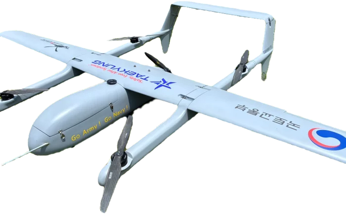
TAEKYUNG ELEC. Co., LTD.
e-VTOL-350
Our e-VTOL drone offers versatile vertical take-off and landing capabilities with precise and stable flight. Equipped with advanced sensors and real-time camera monitoring, it ensures safe and efficient operations in diverse environments.

Aeroforce Logistics, LLC
AV2 Vendetta Fixed Wing Helmet
The
AV2.2 Next Generation Fixed Wing Helmet, a groundbreaking advancement in pilot
headgear. Crafted with precision and designed for excellence, the AV2.2 sets a
new standard for safety, comfort and performance. Key features include 21%
lighter weight, 22% enhanced center of gravity, 2.6 degree increase field of
view, Rotatable Bayonet Receivers, Intelligent Cooling Ports, and Fit System
Dial Knob. The helmet is designed for versatile configurations, modification
kits are available to easily adapt it to any setup.

View page in English


디렉터리 기능
전시회 도우미
In-depth Exhibitor Profiles
Each exhibitor can add as many products and services as they wish, with in-depth information and specifications. This allows buyers to find what they want easily.
Self Provisioning for Exhibitors
Each exhibitor has full control of their content - to edit their company profile, upload products and enter staff details.
방문 계획 수립
북마크 도구와 이벤트 플래너를 사용해 방문하고자 하는 기업과 관심 있는 제품을 검색하세요. 저장한 모든 항목을 조회할 수 있습니다
고급 검색
고급 검색 기능을 사용하여 상품, 인물, 기업의 위치를 빠르게 조회할 수 있습니다. 최첨단 기술을 통해 모든 참가사의 정보를 철저히 스캔하여 세밀하고 관련성 있는 정보를 제공합니다
상호작용 가능 평면도
디렉터리를 사용해 전시회를 손쉽게 둘러보세요. 방문하고자 하는 기업의 위치와, 행사장 내 식당, 화장실, 출입구를 평면도에서 찾을 수 있습니다.
플랫폼 내 메시지
플랫폼 상의 전시 참가사와 관람객에게 직접 연락하여 미팅을 신청하거나 추가 정보를 요청하세요.
최신 콘텐츠
기업, 상품, 뉴스, 이벤트
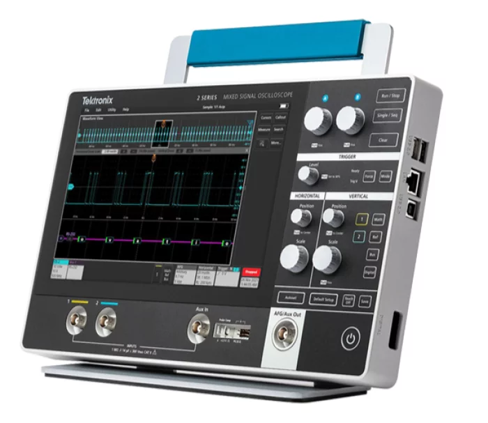
GnK Solution
MSO24
Mixed Signal Oscilloscope (4) Analog Channels, 10M record length, Certificate of Traceable Calibration Standard
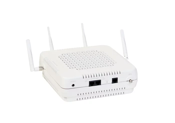
EUCAST
EL2000 - LTE indoor (eNodeB)
The EL2000 is an LTE femtocell developed for indoor use, providing seamless LTE service in environments such as homes or offices.
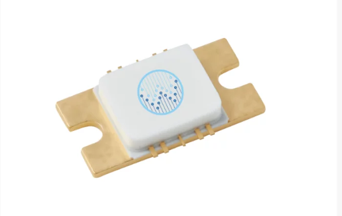
WAVEPIA
Broadband MMIC PA - WPGM0206012M
WPGM0206012M is a 12W Gallium Nitride (GaN) Monolithic Microwave Integrated Circuit (MMIC).
WPGM0206012M is useful for various application as it is covering from 0.5GHz to 8.5GHz.
Spec :
Frequency : 0.5-8.5GHz
Saturated Output Power : 19.5W@4GHz
PAE : 22.49%
Power Gain : 5.91dB@4GHz
Operating Voltage : 48-50V
Please contact WAVEPIA for more information.

Ho-Ho-Kus, Inc.
Nacelles
Our products include latches, hinges, keepers and hold open rods.