한국어로 페이지 보기
Seoul ADEX 2025 Digital Directory
Plan your trip to Seoul ADEX 2025 using our state of the art Digital Directory
Register in seconds with just your email


Directory Features
To help you at the show
In-depth Exhibitor Profiles
Each exhibitor can add as many products and services as they wish, with in-depth information and specifications. This allows buyers to find what they want easily.
Self Provisioning for Exhibitors
Each exhibitor has full control of their content - to edit their company profile, upload products and enter staff details.
Plan your trip
Use the bookmarking and event planning tool to research the companies you would like to visit and the products you are interested in finding. You will be able to locate all of your saved companies on our floorplan
Advanced Search
Utilize our advanced search function to quickly locate products, people, and companies. Our state-of-the-art technology thoroughly scans all exhibitor information, delivering precise and relevant results
Interactive Floorplan
Navigate the show effortlessly with our directory. Use the floorplan to locate companies you want to visit and to find your way to onsite restaurants, toilets and site entrances and exits.
On-platform Messaging
Reach out to exhibitors and visitors directly on our platform to set up meetings, or request more information.
Some of our latest content
Companies, Products, News, Events
_700.webp)
BAE Systems
Hawk Advanced Jet Trainer
With an unrivalled pedigree of delivering the pilots of the future for air forces across the globe, Hawk is the world's most successful and proven military aircraft trainer - with operational capability.
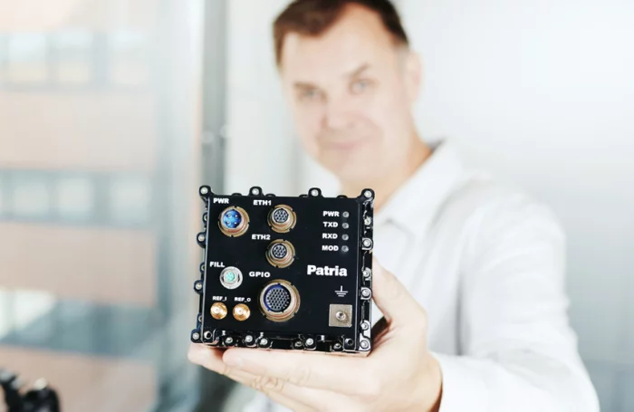
Patria
Patria CANDL - Compact Airborne Networking Data Link
Patria CANDL provides a single data link solution for communications requiring high reliability, such as UAS payload data and C2. It enables air-to-air and air-to-ground Ad Hoc Networking as well as relaying for BLOS capability, thus enabling capabilities such as MUMT - Manned UnManned Teaming and LVC – Live Virtual Constructive training.
8 Mbps data rate with additional safety features for C2, dynamic Ad Hoc Networking communication, motion video and digital voice capability are all integrated in one Software Defined Radio based compact airworthy terminal.
Our CANDL covers NATO IV C-band as well as WRC 2012 defined civil UAS C2 frequency band in single housing enabling both military and civil UAS applications. Networking and range performance can be further extended with optional external HPA (High Power Amplifier) module.
C2 & Payload Data
Secure Command & Control for UAV platforms, payload and missiles
Payload data (HD video, IR, SAR) for manned/unmanned platforms
Distribution of situational awareness through networked data transfer for fighters
Operation in GPS-denied environment
Platform independent system (air, naval, ground)
Legacy systems upgrade for enhanced performance
Manned-Unmanned Teaming (MUMT)
Force multiplier in hostile environment
Multi-platfrom and swarming capability
Mission distributed decision-making and co-ordination
Optimisation of the role and performance of the platform on-the-fly
Real-time communication through ad-hoc IP-network
Live Virtual Constructive (LVC) Training
Cost effectiveness utilising simulators and synthetic forces
More demanding and easily scalable training scenarios
Hiding warfighting tactics into secure digital environment
Enabling complex training scenarios for manned and unmanned platforms
Joint-networked, real-time communication between all Live, Virtual and Simulated assets
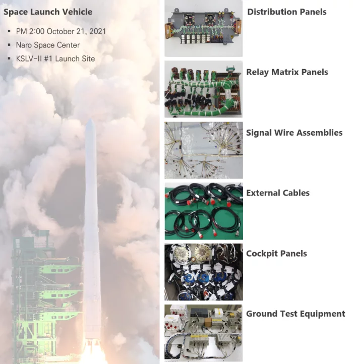
CAPHMICRO Inc.
Wireharness
CAPHMICRO has the ability to design and manufacture wire harnesses and cable assemblies for defense, aerospace, and space launch vehicles/satellites. We design and manufacture in compliance with IPC-620 and J-STD-001 standards. Additionally, we have a global supply chain capable of quickly supplying a wide range of materials. We provide comprehensive solutions for wire harnesses, from design through to manufacturing and inspection.
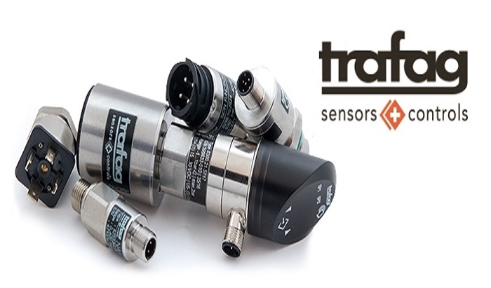
PEI-Genesis
Sensors and Controls

View page in English


디렉터리 기능
전시회 도우미
In-depth Exhibitor Profiles
Each exhibitor can add as many products and services as they wish, with in-depth information and specifications. This allows buyers to find what they want easily.
Self Provisioning for Exhibitors
Each exhibitor has full control of their content - to edit their company profile, upload products and enter staff details.
방문 계획 수립
북마크 도구와 이벤트 플래너를 사용해 방문하고자 하는 기업과 관심 있는 제품을 검색하세요. 저장한 모든 항목을 조회할 수 있습니다
고급 검색
고급 검색 기능을 사용하여 상품, 인물, 기업의 위치를 빠르게 조회할 수 있습니다. 최첨단 기술을 통해 모든 참가사의 정보를 철저히 스캔하여 세밀하고 관련성 있는 정보를 제공합니다
상호작용 가능 평면도
디렉터리를 사용해 전시회를 손쉽게 둘러보세요. 방문하고자 하는 기업의 위치와, 행사장 내 식당, 화장실, 출입구를 평면도에서 찾을 수 있습니다.
플랫폼 내 메시지
플랫폼 상의 전시 참가사와 관람객에게 직접 연락하여 미팅을 신청하거나 추가 정보를 요청하세요.
최신 콘텐츠
기업, 상품, 뉴스, 이벤트
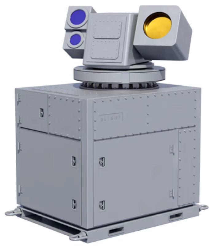
nLIGHT Inc
C-UAS and Advanced Threats 70kW CBC HEL Effector
C-UAS and Advanced Threats 70kW CBC HEL Effectors
Integrated Procurement Technologies
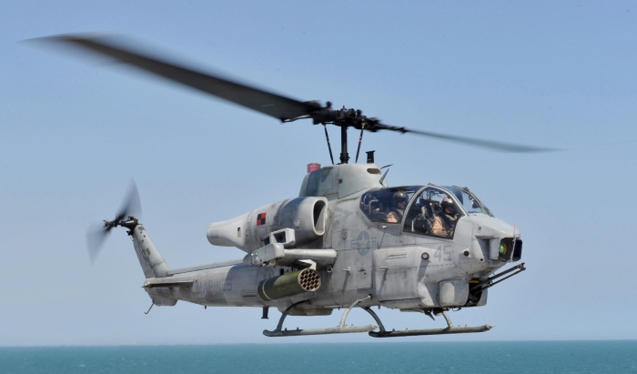
AH-1 Cobra
EMCORE
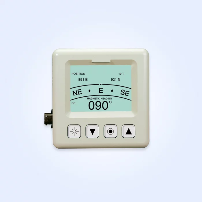
TACNAV® UMD
Built with a rugged design and clear display, the TACNAV UMD offers:
Highlights
Active dot-matrix design, delivering unparalleled flexibility
User-friendly interface with easy-to-read icons, messages, and pop-up menus
Features
Generation III NVG (night vision goggle)-compatible
Four “soft keys” for easy operation
Interchangeable with both Commander’s and Driver’s Displays, reducing logistics and cost
Military standard approved for outstanding performance and reliability
Ideal for integration into digital Battle Management Systems
Compatible with all existing and future EMCORE TACNAV systems
Applications
Military vehicle requiring a user-friendly interface for its tactical navigation system
The TACNAV UMD is controlled by the Arms Export Control Act (Title 22, USC Sec 2751 et seq.) and the International Traffic in Arms Regulations, ITAR 22 CFR 120-130, and may not be exported from the United States or disclosed to a foreign person in the United States except as authorized by those regulations.

SU Optics
ACTUS® ARKS5225 Long Range Riflescope
The ACTUS® ARKS5255 (5-25X, 56mm FFP) Long Range Riflescope is designed for precision and durability, meeting the needs of professional users across a wide range of environments.
Equipped with a First Focal Plane (FFP) optical design, it enables fast and accurate target coverage at any magnification level. The illuminated reticle ensures smooth and clear targeting in low-light conditions, such as during dawn or dusk.
Whether in challenging operational environments or critical moments, the ACTUS® ARKS5255 is the ideal riflescope for users seeking superior performance when it matters most.