한국어로 페이지 보기
Seoul ADEX 2025 Digital Directory
Plan your trip to Seoul ADEX 2025 using our state of the art Digital Directory
Register in seconds with just your email


Directory Features
To help you at the show
In-depth Exhibitor Profiles
Each exhibitor can add as many products and services as they wish, with in-depth information and specifications. This allows buyers to find what they want easily.
Self Provisioning for Exhibitors
Each exhibitor has full control of their content - to edit their company profile, upload products and enter staff details.
Plan your trip
Use the bookmarking and event planning tool to research the companies you would like to visit and the products you are interested in finding. You will be able to locate all of your saved companies on our floorplan
Advanced Search
Utilize our advanced search function to quickly locate products, people, and companies. Our state-of-the-art technology thoroughly scans all exhibitor information, delivering precise and relevant results
Interactive Floorplan
Navigate the show effortlessly with our directory. Use the floorplan to locate companies you want to visit and to find your way to onsite restaurants, toilets and site entrances and exits.
On-platform Messaging
Reach out to exhibitors and visitors directly on our platform to set up meetings, or request more information.
Some of our latest content
Companies, Products, News, Events
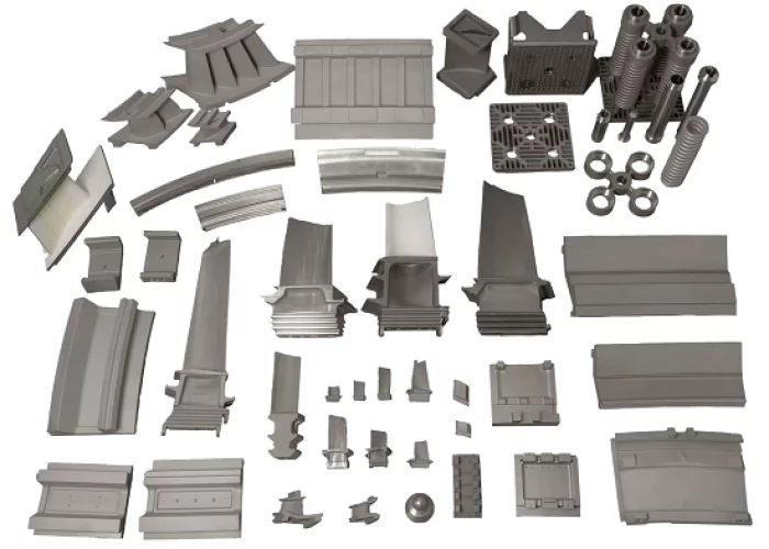
Korea Lost-wax Co., Ltd
Power Generation Equipment
We are recognized domestically and internationally for our technology and quality by supplying products manufactured based on our accumulated know-how and excellent technology to power generation equipment companies at home and abroad.
_700.webp)
BIBUS METALS KOREA
Titanium and Titanium alloys
Titanium Grade 1
-Strip
Titanium Grade 2
-Bars-Sheets and Plates-Tubes and Pipes
Titanium Grade 4
-Bars-Sheets and Plates-Wire
Titanium Grade 5 (6Al-4V)
-Bars-Sheets and Plates
Titanium Grade 5 ELI
-Bars-Sheets and Plates
Titanium Grade 7
-Bars-Sheets and Plates-Tubes and Pipes
Titanium Grade 9 (3AL2.5V)
-Tubes and Pipes
Titanium Ti-6Al-7Nb
-Bars
_700.webp)
Woori HQ Inc.
Air Conditioners
an air conditioner mounted inside the tank
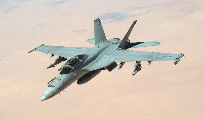
Marvin Test Solutions
F/A-18 Test and Support Equipment

View page in English


디렉터리 기능
전시회 도우미
In-depth Exhibitor Profiles
Each exhibitor can add as many products and services as they wish, with in-depth information and specifications. This allows buyers to find what they want easily.
Self Provisioning for Exhibitors
Each exhibitor has full control of their content - to edit their company profile, upload products and enter staff details.
방문 계획 수립
북마크 도구와 이벤트 플래너를 사용해 방문하고자 하는 기업과 관심 있는 제품을 검색하세요. 저장한 모든 항목을 조회할 수 있습니다
고급 검색
고급 검색 기능을 사용하여 상품, 인물, 기업의 위치를 빠르게 조회할 수 있습니다. 최첨단 기술을 통해 모든 참가사의 정보를 철저히 스캔하여 세밀하고 관련성 있는 정보를 제공합니다
상호작용 가능 평면도
디렉터리를 사용해 전시회를 손쉽게 둘러보세요. 방문하고자 하는 기업의 위치와, 행사장 내 식당, 화장실, 출입구를 평면도에서 찾을 수 있습니다.
플랫폼 내 메시지
플랫폼 상의 전시 참가사와 관람객에게 직접 연락하여 미팅을 신청하거나 추가 정보를 요청하세요.
최신 콘텐츠
기업, 상품, 뉴스, 이벤트
_700.webp)
FIRSTEC CO., LTD.
Ammunition Bearer Control Panel
Device for checking turret operation, turret fan control, air conditioning control, and status.
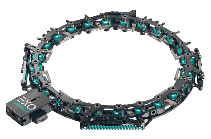
Exolaunch
CarboNIX
CarboNIX is a scalable shock-free separation system for microsats weighing between 10 and 500kg. It is available in 8'', 11,732'', 15'', 18.25'', 24'' and custom diameter sizes.
CarboNIX's patented synchronous spring pusher system deploys satellites smoothly and evenly, with no unnecessary shocks or tumbling, thus minimizing risk of damage to a satellite's sensitive optical payloads and electronic components. It is the lowest-shock and lowest-tumbling separation system ever deployed in space.
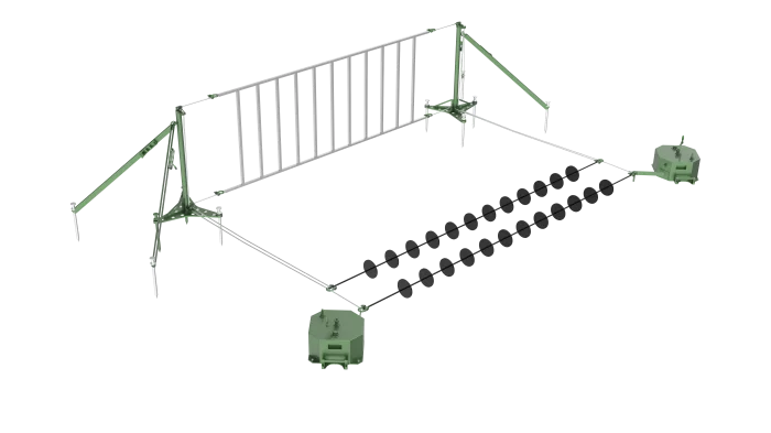
FINE KOWAC Co., Ltd.
UAV Recovery System_XROSS R1000
It is an UAV recovery system that lands a fixed-wing UAV even in mountainous terrain where there is no sufficient runway for landing.
Similar to the arresting hook method used to land an aircraft on an aircraft carrier, the UAV is caught by a pendant and braked, and a net is also added in case of an emergency.
GIFAS
Our vision
The aerospace industry has brought one of humanity's oldest dreams to life, a dream that seemed out of reach for so long : the ability to fly, to travel among the stars. Symbolizing freedom, discovery and travel, airplanes bring people together and foster cultural exchange.